Catalog Archive
Auction 168, Lot 611

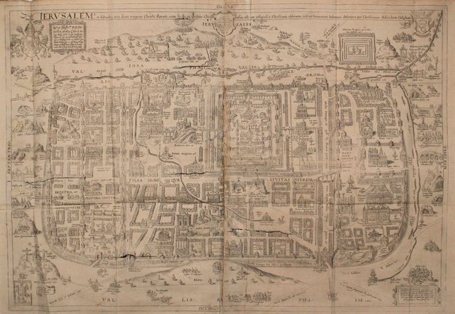
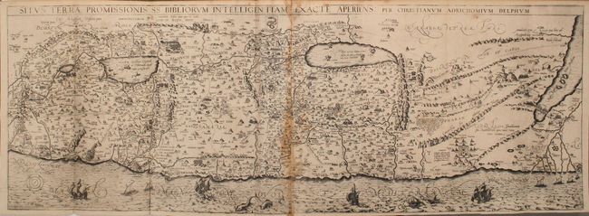
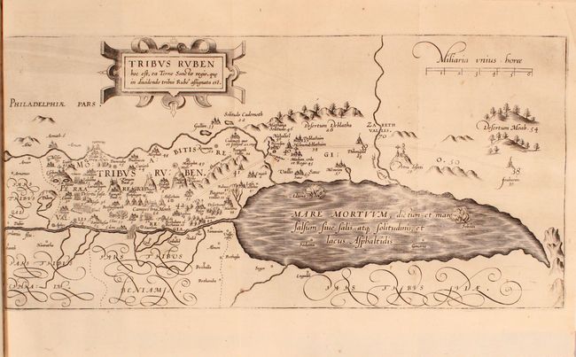
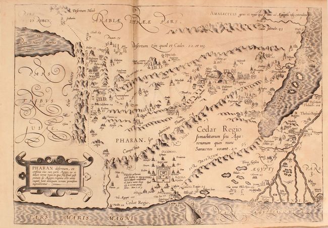
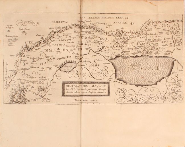
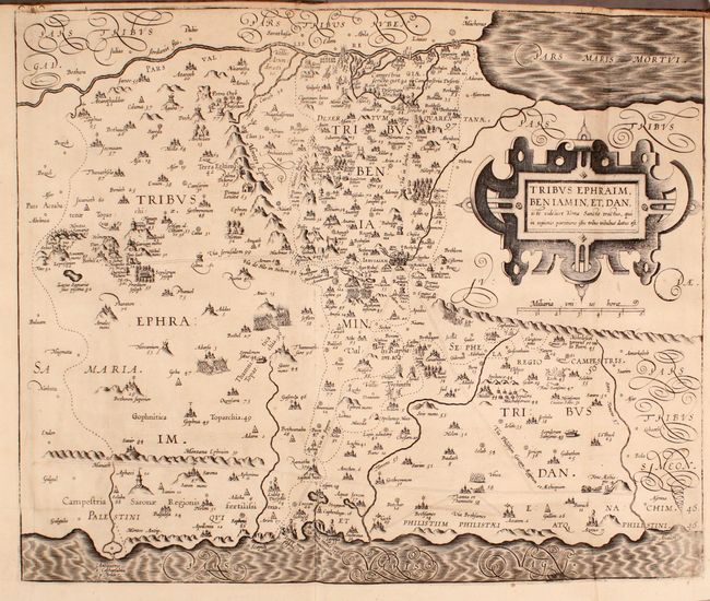
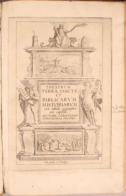
Adrichom's Influential Maps of Jerusalem and the Holy Land

"Theatrum Terrae Sanctae et Biblicarum Historiarum cum Tabulis Geographicis aere Expressis", Adrichom, Christian van

Subject: Holy Land, Atlases

Period: 1682 (circa)

Publication:

Color: Black & White

Size:
10 x 15 inches
25.4 x 38.1 cm
Download High Resolution Image
(or just click on image to launch the Zoom viewer)

This atlas and history of the Holy Land is Adrichom's most important and famous work. Born in Delft, Christian Kruik van Adrichem, or Christianus Crucius Adrichomius, was a Catholic priest and theologian. Adrichom worked for thirty years on his three-part history of the Holy Land, and only succeeded in publishing the first part, Urbis Hierosolyma Depicta, during his lifetime. The remaining two parts were published posthumously by Georg Braun in 1590, with subsequent editions in 1593, 1600, 1613, 1628, and 1682. The Theatrum Terrae Sanctae contained 12 maps and plans: one of the Holy Land, ten of territories of the Tribes of Israel, and a town plan of Jerusalem.

Kenneth Nebenzahl considers Adrichom's plan of Jerusalem "the most dramatic and important of the sixteenth century." Again, Adrichom used a myriad of sources to develop his plan, including Bernhard von Breitenbach's woodcut panorama of the city, Sebastian Munster's view, the texts of pilgrims Burchard of Mt. Sion and William Wey, and the Bible and Josephus. The plan is oriented to the north with the camps of the historic city's invaders just outside the city walls, and the ancient City of David and Mt. Sion in the south. There are over 250 key locations identified and numbered, which are more fully described in Adrichom's text. One of the most important contributions of the plan is Adrichom's identification of the locations of fourteen sites of the Stations of the Cross, which are still accepted today. Adrichom's plan of Jerusalem remained the definitive layout of the city until archaeological discoveries during the nineteenth century. Condition: A slightly uneven impression with several cracks visible in the plate and light staining along the joint. There are two holes (about 1" x 0.5") in the image at far left that have been professionally repaired with the image replaced in facsimile. (B)

Adrichom's stunning map of the Holy Land, Situs Terrae Promissionis, was based on numerous sources, including Peter Laicksteen and Christian Sgrooten, Tilleman Stella, Jacob Ziegler, Sebastian Munster, Gerard Mercator, Buchard of Mt. Sion, and even Josephus, Jerome and Ptolemy. This map became immediately popular with leading cartographers such as Jan Jansson and Nicholas Visscher, who used it as the basis for their own maps of the Holy Land. North is oriented to the bottom left, and the map is divided into the tribes. The Kishon River erroneously connects the Sea of Galilee with the Mediterranean. The map is finely engraved with minute detail and depicts numerous biblical scenes including the Jonah and the Whale and several battle scenes. Sailing ships, sea monsters, Adrichom's coat of arms, and a compass rose complete the composition. Condition: There is some staining along the joint, light scattered soiling, and a small hole in the Mediterranean at right that has been professionally repaired. (B)

Complete. Folio, 286 pp., 12 maps, title page, preface and index. Hardbound in full vellum with manuscript paper title label on spine.

References: Nebenzahl (Holy Land), pp. 90-91 & 94-97; Laor #7-18 & 934.

Condition:

See the description above for details on the condition of the two large folding maps. The 10 maps of the tribes are mostly in "A" condition with dark impressions and minor occasional soiling or misfolds. The exceptions are the map of Iuda with light offsetting and some staining along the centerfold (B) and the map of Pharan with light toning and a tear that extends 1/2" into map at bottom (B+). The text has light toning and an occasional spot of foxing. There are small worm tracks along the edges of the first 40 pages and along pages 95-114 that are confined to the blank margin and do not impact any of the text or maps; some of the worm tracks have been closed with cello tape. The hinges are starting and the covers and spine are soiled with bumped corners and a few small chips.

Estimate: $2,400 - $3,000

Unsold

Closed on 6/6/2018

Archived