Catalog Archive
Auction 168, Lot 605

"Iudaea, seu Terra Sancta quae Hebraeorum sive Israelitarum in suas Duodecim Tribus Divisa...", Sanson/Jaillot
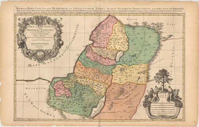
Subject: Holy Land

Period: 1681 (circa)

Publication:

Color: Hand Color

Size:
33.1 x 20.9 inches
84.1 x 53.1 cm
Download High Resolution Image
(or just click on image to launch the Zoom viewer)

This spectacular map of the Holy Land shows the division of Judea into the Twelve Tribes of Israel. The map is based on the cartography of Guillaume and Nicholas Sanson and is from a series of greatly enlarged maps published by Jaillot in collaboration with the heirs of Sanson. It is filled with notations, topography and place names, including the locations of Gomorra, Sodoma, Seboim and Adama as flaming cities in the Dead Sea. There are a pair of extravagant cartouches adorning this map. The title cartouche is festooned with garlands, ribbons and fruit, and is surmounted by the French royal coat of arms and flanked by the figures of Moses and Aaron. At the foot of the title cartouche is a minutely engraved medallion featuring Moses and the brazen serpent. The distance scale cartouche includes the key to the royal and priestly cities and sanctuaries. It is topped by a scene of Adam and Eve in the Garden of Eden, with the serpent and the Tree of Knowledge of Good and Evil. Engraved by Cordier. This is the second state with the date removed from the lower cartouche. Printed on 2 joined sheets, as issued.

References: Laor #367; Pastoureau, JAILLOT I Aa #45.

Condition: B+

A nice impression with full contemporary color. There is light toning and some small chips and tears along the edges of the sheet. The joint has come loose in the top blank margin and at bottom extending 2" into map, with both repaired with archival tape.

Estimate: $600 - $750

Sold for: $450

Closed on 6/6/2018

Archived