Catalog Archive
Auction 168, Lot 435

"The Countie Pallatine of Lancaster Described and Divided into Hundreds 1610", Speed, John

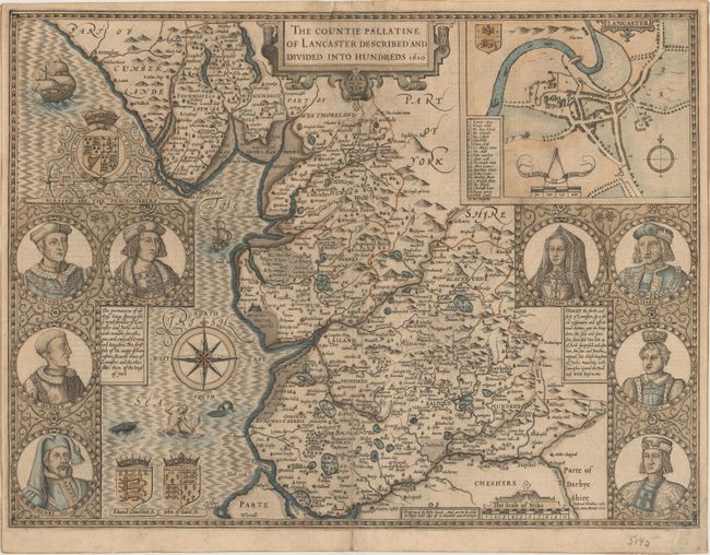
Subject: Lancaster, England

Period: 1610 (dated)

Publication: Theatre of the Empire of Great Britaine

Color: Hand Color

Size:
20.1 x 15 inches
51.1 x 38.1 cm
Download High Resolution Image
(or just click on image to launch the Zoom viewer)

This county map of Lancastershire is divided into hundreds and displays interesting detail including the locations of towns, beaches, rivers, forests and parks. An inset at top right shows the city of Lancaster with a key to 22 important locations. Flanking the map at left are portraits of Henry IV through VII (Lancaster Kings), and at right are portraits of Edward IV and V, Richard III, and Queen Elizabeth I (York Kings/Queen). The map is further adorned by three coast of arms, two sailing ships, sea monster, mermaid, and compass rose. Engraved by Jodocus Hondius and sold by George Humble circa 1627. English text on verso.

References: Shirley (BL Atlases) T.SPE-1e.

Condition: B

A dark impression with a 4" centerfold separation at bottom and a 1.5 x 3" chip at the top of the centerfold that have both been archivally repaired on verso with tissue. There is also a small chip in the bottom right corner of the sheet that has been reattached on verso with tissue with a small portion of border replaced in facsimile.

Estimate: $900 - $1,100

Sold for: $600

Closed on 6/6/2018

Archived