Catalog Archive
Auction 168, Lot 40

"Tableau des Regions Circumpolaires ou Carte Spheroidale des Deux Poles...", Garnier, Francis Marie Joseph
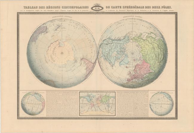
Subject: Polar

Period: 1860 (dated)

Publication: Atlas Spheroidal & Universel de Geographie

Color: Hand Color

Size:
28.3 x 19 inches
71.9 x 48.3 cm
Download High Resolution Image
(or just click on image to launch the Zoom viewer)

This handsome double hemisphere maps shows the Hemisphere Austral and Hemisphere Boreal. It includes place names and some topographical detail. Beneath the main map are three inset maps detailing the inclination and declination of the earth. Two blocks of text provide notes on the map's geography and magnetic phenomena. The map is surrounded by a keyboard-style border. Printed in Paris by Sarazin.

Garnier's Atlas Spheroidal & Universel de Geographie is quite rare and sought-after for its elegant hand coloring, precise engraving, and decorative maps.

References:

Condition: B+

Minor scattered foxing and faint color offsetting.

Estimate: $100 - $130

Sold for: $75

Closed on 6/6/2018

Archived