Catalog Archive
Auction 168, Lot 387

"Plan des Villes, Forts, Port, Rade et Environ de Cartagene Situee dans l'Amerique Meridionale dans la Province de Terre Ferme Appartenant aux Espagnols", Fer, Nicolas de

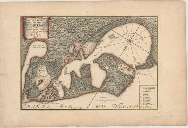
Subject: Cartagena, Colombia

Period: 1700 (dated)

Publication: L'Atlas Curieux ou le Monde...

Color: Hand Color

Size:
12.6 x 8.8 inches
32 x 22.4 cm
Download High Resolution Image
(or just click on image to launch the Zoom viewer)

This map of Cartagena and the surrounding bay depicts the important port city as a bird's-eye plan with a numbered key identifying 12 locations. Three forts surrounding the city and bay are shown. The surrounding countryside is filled with vegetation, trails, and a hew houses. A fleur-de-lis orients north to the bottom left of the map. Adorned with a drape-style cartouche and engraved by C. Inselin. This is the first state.

References: Kapp (MCC-77) #39; Pastoureau, FER I A [22].

Condition: A

A nice impression with minor toning, marginal soiling, and some tiny edge tears.

Estimate: $300 - $375

Sold for: $650

Closed on 6/6/2018

Archived