Catalog Archive
Auction 168, Lot 29

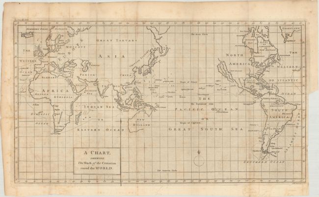
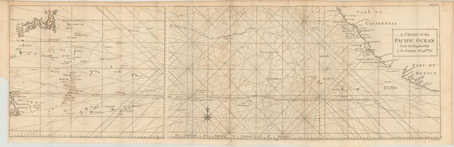
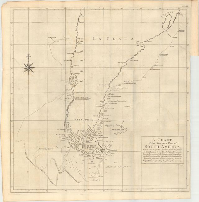
"[Lot of 3] A Chart, Shewing the Track of the Centurion Round the World [and] A Chart of the Pacific Ocean from Equinoctial to the Latitude of 39 1/2d No. [and] A Chart of the Southern Part of South America... ", Anson, George

Subject: World

Period: 1769 (circa)

Publication: A Voyage Round the World

Color: Black & White

Size:
See Description
Download High Resolution Image
(or just click on image to launch the Zoom viewer)

These three maps are from the 14th edition of Anson's A Voyage Round the World:

A. A Chart, Shewing the Track of the Centurion Round the World (16.0 x 8.9"). This chart delineates Anson's world circumnavigation, one of the last great buccaneering voyages. Details in the chart are limited to the immediate region affected by the voyage leaving continental interiors blank save for large rivers, lakes, and seas and important cities. California is depicted as an island, and is a very late depiction of this cartographic error.

B. A Chart of the Pacific Ocean from Equinoctial to the Latitude of 39 1/2d No., (34.6 x 10.8"). An unusual chart on two joined sheets detailing the route of Spanish galleons between the Philippines and Acapulco. The tracks of British Navy Commodore George Anson and Spanish Nostra Seigniora de Cabadonga are shown. A somewhat speculative depiction of the islands of Japan is shown at top left.

C. A Chart of the Southern Part of South America; with the Track of the Centurion from the Island of St. Catherines to the Island of Juan Fernandes... (19.3 x 20.0"). This handsome chart shows the route of Capt. George Anson's expedition from St. Catherine's Island off the coast of Brazil, around Cape Horn and up to Juan Fernandes Island (now known as Robinson Crusoe Island) off the coast of Chili. This chart shows numerous calculations of water depth, ocean currents, and includes navigational notes. A decorative compass rose with fleur-de-lys is positioned in the sea.

During the War of Jenkins' Ear, Anson set sail in 1740 in command of a squadron sent to attack Spanish possessions and interests in South America. The expedition was ill-equipped and failed to carry out its original ambitious mission. By June 1741 when Anson reached Juan Fernandes, his force had been reduced to only three of the original six ships, while the strength of his crews had fallen from 961 to 335. After recuperating on the island, he collected the remaining survivors on his flagship, the Centurion, and set sail in search of one of the richly laden galleons that conducted the trade between Mexico and the Philippines. The indomitable perseverance he had shown during one of the most arduous voyages in the history of sea adventure gained the reward of the capture of an immensely rich prize, the Nuestra Senora de Cabadonga, which he encountered off Cape Espiritu Santo on June 20, 1743.

References: cf. Shirley (BL Atlases) G.ANS-1a.

Condition: B+

Issued folding on watermarked paper with light toning and offsetting. The map of South America also has a 1.25" binding tear at right that has been closed on verso with archival material.

Estimate: $450 - $550

Sold for: $325

Closed on 6/6/2018

Archived