Catalog Archive
Auction 168, Lot 250

"The State of Kentucky with the Adjoining Territories, from the Best Authorities", Low, E.

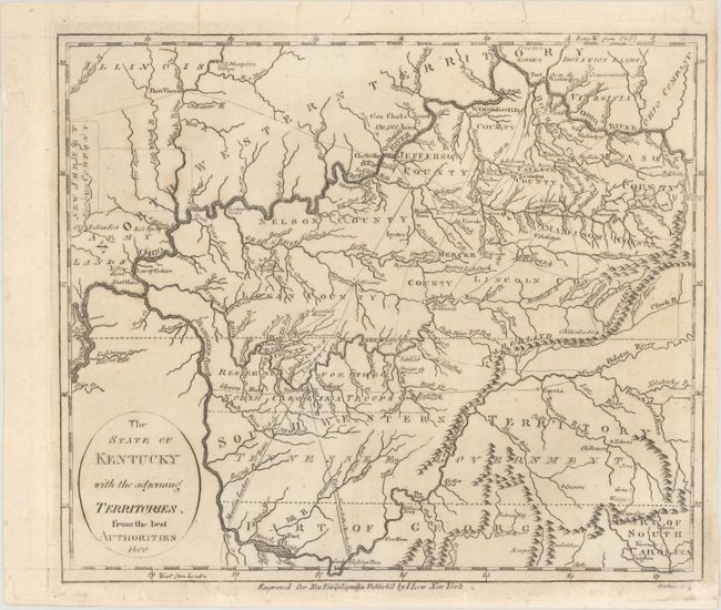
Subject: Kentucky & Tennessee

Period: 1800 (dated)

Publication: New Encyclopaedia

Color: Black & White

Size:
8.6 x 7.4 inches
21.8 x 18.8 cm
Download High Resolution Image
(or just click on image to launch the Zoom viewer)

A scarce map of Kentucky with the Tennesee Government / South Western Territory named below and the North Western Territory above. There are several Bounty Land Grants named on the map, including a large portion of northwest Tennessee noted as 'Reserved for the North Carolina Troops'. General Clark's Grant is named on the border with present-day Ohio, and the New Jersey Company is in possession of a large piece of land in what would become Illinois. This map was derived from the 1794 map by John Russell. Engraved by John Scoles.

References:

Condition: B+

A mostly clean, bright example with minor edge tears and chips in the blank margins. The lower margin has been extended and the left and top margins have been reinforced.

Estimate: $300 - $375

Sold for: $450

Closed on 6/6/2018

Archived