Catalog Archive
Auction 168, Lot 236

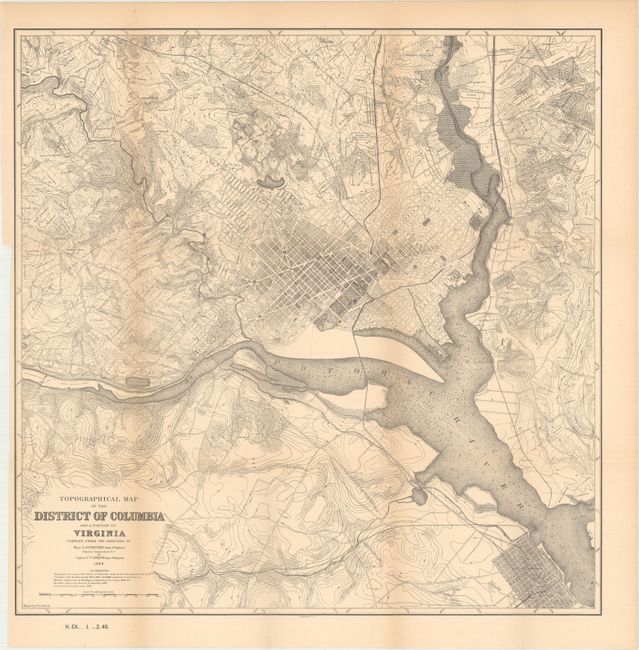
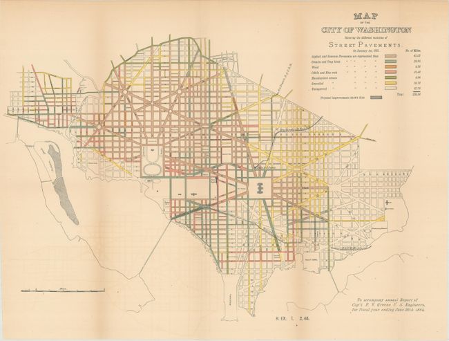
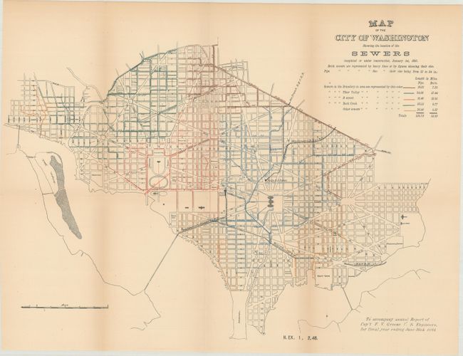
"[Lot of 3] Topographical Map of the District of Columbia and a Portion of Virginia... [and] Map of the City of Washington Showing the Different Varieties of Street Pavements [and] Map of the City of Washington Showing the Location of the Sewers...", U.S. Corps of Engineers

Subject: Washington, D.C.

Period: 1885 (published)

Publication: House Ex. Doc. 1, 48th Congress, 2nd Session

Color:

Size:
See Description
Download High Resolution Image
(or just click on image to launch the Zoom viewer)

These three maps were included in a government report related to the District's early infrastructure. Beginning in the early 1870's, population growth exploded and the city lacked the basic infrastructure to support it. In 1874, Congress created a three-person Board of Commissioners to become the permanent government for the District. Over the next several decades, much was done by the Commission to improve living conditions and infrastructure including paved roads, new water lines, and upgraded sewer capacity. These maps reflect the progress of those efforts.

A. Topographical Map of the District of Columbia and a Portion of Virginia..., black & white (20.6 x 20.7"). A very detailed map covering the vicinity of Washington DC including Alexandria, Virginia. The map shows the city's street pattern including the National Mall, with extensive land ownership identified outside of the city. The map was compiled from maps made by the U.S. Coast and Geodetic Survey 1879-84, military maps made in 1861-65, Boschke's map of 1861, and Carpenter's Assessment maps from 1882.

B. Map of the City of Washington Showing the Different Varieties of Street Pavements, hand color (19.5 x 14.2"). This thematic map is color-coded to show seven types of road surfaces covering approximately 230 miles. Shaded roads indicate proposed improvements.

C. Map of the City of Washington Showing the Location of the Sewers..., hand color (19.5 x 14.2"). Another thematic map color-coded to show the various sewer systems, including both brick and pipe systems, totaling 177 miles.

References:

Condition: B+

Issued folding with light toning. The second map (street pavements) also has faint color offsetting and two small edge tears in unengraved areas that have been closed on verso with archival tape.

Estimate: $250 - $325

Sold for: $150

Closed on 6/6/2018

Archived