Catalog Archive
Auction 168, Lot 205

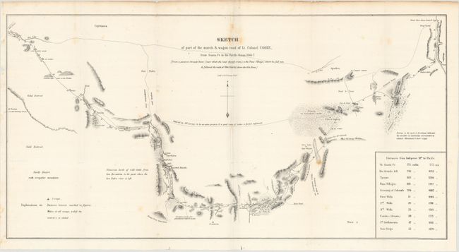
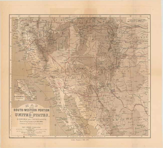
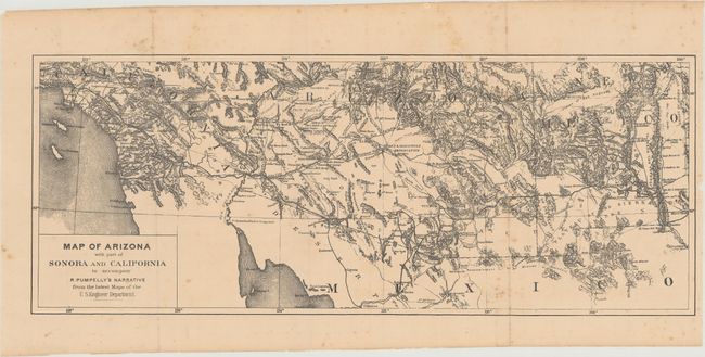
"[Lot of 3] Sketch of Part of the March & Wagon Road of Lt. Colonel Cooke... [and] Map of the South-Western Portion of the United States, and of Sonora and Chihuahua... [and] Map of Arizona with Part of Sonora and California...",

Subject: Southwestern United States

Period: 1848-70 (circa)

Publication:

Color:

Size:
See Description
Download High Resolution Image
(or just click on image to launch the Zoom viewer)

A. Sketch of Part of the March & Wagon Road of Lt. Colonel Cooke, from Santa Fe to the Pacific Ocean 1846-7..., by Lt. Colonel Cooke, circa 1848, black & white (22.8 x 11.7"). In 1846, when Stephen W. Kearny led the Army of the West in the conquest of New Mexico and California he was accompanied by officers of the Corps of Topographical Engineers. Lt. W.H. Emory followed Kearny across the desert and produced the expedition's main map. Lt. Col. Phillip, Lt. George Cooke and the "Mormon Battalion" took a more southerly route through the Guadeloupe Mountains and Tucson and produced this modest but important map. It records only the country actually seen; the exception being a dotted line inscribed "Believed by M. Leoux to be an open prairie good route if water is found sufficient." Antoine Leroux was a famed mountain man who was acting as guide for the expedition, but he was wrong about that alternate route. Wheat finds this to be a "magnificent achievement" drawing public attention to a stretch of territory deemed essential for a wagon and rail route that was later included in the Gadsden Purchase. The map terminates at the Pima Villages on the Gila (near present day Phoenix) where he picked up Kearney's trail. Condition: Issued folding on a bright sheet with a few spots of foxing.

B. Map of the South-Western Portion of the United States, and of Sonora and Chihuahua. Illustrating Travels by Dr. W.A. Bell, by E.G. Ravenstein, dated 1870, printed color (14.5 x 12.6"). This map was issued in Bell's New Tracks in North America..., a journal he wrote while surveying a southern railroad route to the Pacific Ocean. Bell's route is shown in red outline and covers a huge circular route in the west. Elevation is well represented through color. Condition: Issued folding with light toning and color offsetting.

C. Map of Arizona with Part of Sonora and California to Accompany R. Pumpelly's Narrative from the Latest Maps of the U.S. Engineer Department, by R. Pumpelly, circa 1870, black & white (16.1 x 6.3"). This map was issued in Raphael Pumpelly's Across America and Asia: Notes of a Five Years' Journey Around the World.... Pumpelly, a geologist and professor at Harvard, was invited by both China and Japan to survey portions of their respective countries. This map presents a portion of his journey from El Paso, Texas to San Pedro, California. Highly detailed, the map shows Indian tribes, reservations, topography, and drainage. Condition: Issued folding with scattered foxing.

References:

Condition: B+

See description above.

Estimate: $250 - $325

Sold for: $250

Closed on 6/6/2018

Archived