Catalog Archive
Auction 168, Lot 194

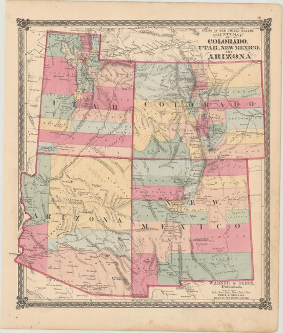
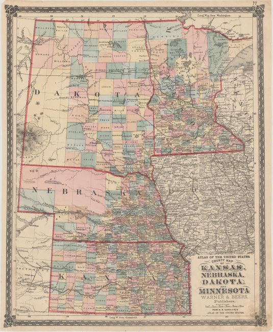
"[Lot of 2] County Map of Colorado, Utah, New Mexico, and Arizona [and] County Map of Kansas, Nebraska, Dakota. And Minnesota", Warner & Beers

Subject: Central & Western United States

Period: 1872 (circa)

Publication: Lloyd's Atlas of the United States

Color: Hand Color

Size:
14.6 x 16.2 inches
37.1 x 41.1 cm
Download High Resolution Image
(or just click on image to launch the Zoom viewer)

This lot is from Warner & Beers uncommon series, published by H.H. Lloyd & Company. The maps include:

The first map (14.6 x 16.2") is centered on the four corners and features early county organization. Arizona has just five counties and locates Maricopas Wells, the future site of Phoenix. Beautifully colored with good detail throughout, the map locates numerous railroads, cities and towns, watershed, forts, etc. There are some early references to mining near Tubac, Arizona and west of the Rockies in Colorado (Oro City). Railroads are in an early stage of development, with lines in Colorado and the Transcontinental line delineated in northern Utah. A handsome map with decorative borders and graphic elements at each corner.

The second map (14.5 x 17.8") shows all of the large Dakota Territory, Minnesota, Nebraska, and Kansas. The northwest of Nebraska and southwest of Dakota show no sign of settlement. There is excellent detail of the numerous railroads, plus scores of towns and villages, and watershed. The same decorative border and corner graphics accent this map.

References:

Condition: B+

Bright original hand coloring with light soiling and a few tiny edge tears that do not enter map image.

Estimate: $200 - $240

Sold for: $75

Closed on 6/6/2018

Archived