Catalog Archive
Auction 168, Lot 17

"Le Monde en Planisphere", Duval, Pierre
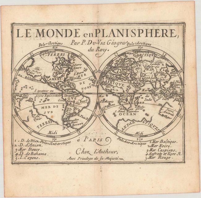
Subject: World

Period: 1676 (circa)

Publication: Le Monde ou la Geographie Universelle

Color: Black & White

Size:
5.1 x 4.1 inches
13 x 10.4 cm
Download High Resolution Image
(or just click on image to launch the Zoom viewer)

This is the first world map created by Duval, first published in 1658. This miniature double-hemisphere map depicts the island of California with Iesso extending between Asia and North America. There are a few place names noted on each continent, including Virginie and Canada in North America. The western outline of Terre Australe is depicted, and a large, partially delineated Terres Antarctiques is shown. The map was updated in 1672 with a numbered key at bottom identifying various straits, seas, and rivers. Pierre Duval was Nicolas Sanson's nephew and pupil. He published a wide range of atlases and individual maps including a fine miniature world geography with many of the maps based on Sanson.

References: Shirley #405; King (2nd ed) pp. 132-135; Pastoureau, Duval XI Fa.

Condition: B+

Watermarked paper with a couple of tiny spots and light toning along the centerfold and edges of the sheet.

Estimate: $240 - $300

Sold for: $120

Closed on 6/6/2018

Archived