Catalog Archive
Auction 168, Lot 142

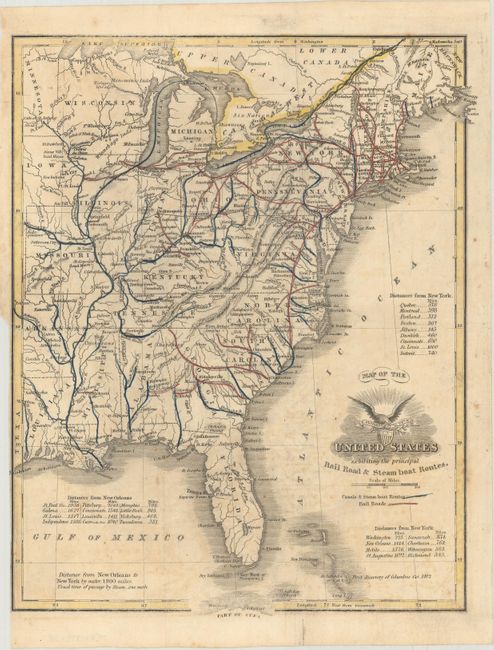
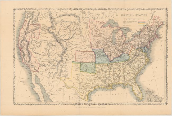
"[Lot of 2] Map of the United States Exhibiting the Principal Rail Road & Steamboat Routes [and] United States",

Subject: United States, Civil War

Period: 1850-61 (circa)

Publication:

Color: Hand Color

Size:
See Description
Download High Resolution Image
(or just click on image to launch the Zoom viewer)

A. Map of the United States Exhibiting the Principal Rail Road & Steamboat Routes, by J.W. Barber, circa 1850 (7.9 x 9.7"). This map of the eastern United States presents the evolving transportation network about a decade before the start of the Civil War. Railroads are highlighted in red outline and canals are shown in blue. Three tables around the map indicate distances from New York and New Orleans. Condition: Issued folding with faint offsetting and minor foxing. A binding trim at lower left is trimmed to the neatline. (B+)

B. United States, by John Rapkin, circa 1861 (16.8 x 10.7"). A fine map covering the entire country, and issued just prior to the beginning of the Civil War. The legend uses color to indicate Federal Non-Slaveholding States, States bordering Slaveholding States, and the Confederate Slaveholding States. Also indicates Indian Territory with its own color. The large Washington Territory, is depicted in the short-lived inverted 'L' configuration, extending east to the Continental Divide and south to the Utah Territory. The proposed Territory of Arizona is shown in the southern part of New Mexico Territory. A huge Dakota Territory extends from Minnesota to Washington. Surrounded by a decorative vine and leaf border. An uncommon pre-Civil War issue that was published by the London Printing and Publishing Company. Condition: Issued folding. (A)

References:

Condition:

See description above.

Estimate: $250 - $325

Sold for: $180

Closed on 6/6/2018

Archived