Catalog Archive
Auction 168, Lot 119

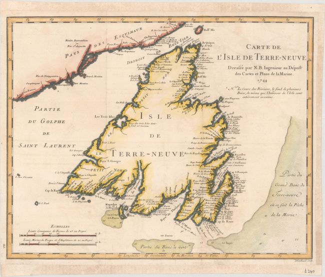
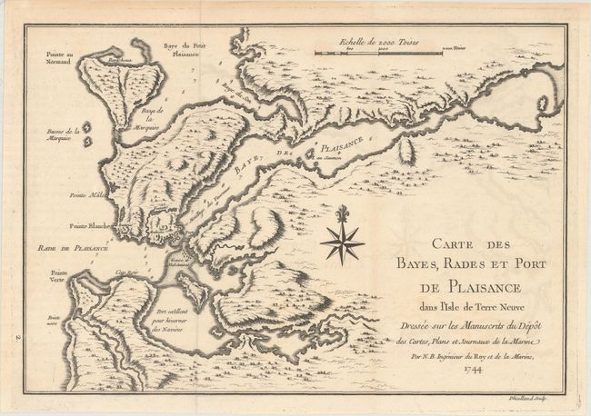
"[Lot of 2] Carte de l'Isle de Terre-Neuve [and] Carte des Bayes, Rades et Port de Plaisance dans l'Isle de Terre Neuve...", Bellin, Jacques Nicolas

Subject: Newfoundland, Canada

Period: 1744 (dated)

Publication: Histoire et Description Generale de la Nouvelle France

Color:

Size:
See Description
Download High Resolution Image
(or just click on image to launch the Zoom viewer)

A. Carte de l'Isle de Terre-Neuve, hand color (14.3 x 11.3"). This is a finely engraved chart of Newfoundland that shows a part of the mainland at upper left and includes the Strait of Belle Isle and part of the Gulf of St. Lawrence. There is no inland detail, but there are a remarkable number of place names along the coastline. The bay and harbor of Plaisance, a former French colony, is noted on the southern coast. Several shoals and fishing banks are indicated through stippling in the sea, with soundings noted. Two distance scales. Engraved by Dheulland. Condition: Issued folding, now flat, on a watermarked sheet with archivally repaired edge tears at bottom (3") and at right (1.25"). Margins have been extended on three sides with old paper.

B. Carte des Bayes, Rades et Port de Plaisance dans l'Isle de Terre Neuve Dressee sur les Manuscrits du Depot des Cartes, Plans et Journaux de la Marine, black & white (11.3 x 7.7"). This chart focuses on Placentia and Argentia harbors on the Avalon Peninsula in Newfoundland. The French fort, village, and battery are shown at the harbor entrance. These harbors were used to overwinter fleets, and the harbors are so marked. Engraved by Dheulland. Condition: Issued folding on a watermarked sheet with minor offsetting.

References: Kershaw #515 & #519.

Condition: B+

See description above.

Estimate: $200 - $230

Sold for: $150

Closed on 6/6/2018

Archived