Catalog Archive
Auction 167, Lot 416

"A Chart of the Strait Between Asia & America with the Coast of the Tschutski, Laid Down from Astronomical Observations, Made in the Icy Sea During the Years 1786 &c. to 1794", Arrowsmith, Aaron, Jr.

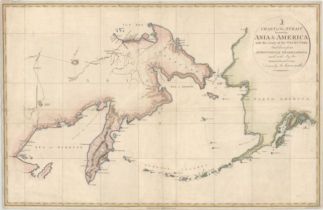
Subject: North Pacific Ocean

Period: 1802 (dated)

Publication: An Account of a Geographical and Astronomical Expedition to the Northern Parts of Russia

Color: Hand Color

Size:
24.5 x 15.8 inches
62.2 x 40.1 cm
Download High Resolution Image
(or just click on image to launch the Zoom viewer)

This detailed chart of the Bering Strait shows Martin Sauer's route through the North Pacific Ocean and overland in parts of Russia. Sauer accompanied Joseph Billings on his expedition in the region from 1785-94. Billings was an Englishman, who was commissioned by Catherine the Great of Russia to search for the Northwest Passage. Sauer published an account of the expedition in London in 1802. This chart gives good detail of the Aleutian Islands, although the western coastline of Alaska is still rudimentary. Published by Cadell & Davies.

References: Falk #1802-2.

Condition: B+

Issued folding with some extraneous creasing, two small spots near the center, and overall light soiling. Margins are narrow, as issued, but still ample for framing.

Estimate: $200 - $230

Sold for: $150

Closed on 3/28/2018

Archived