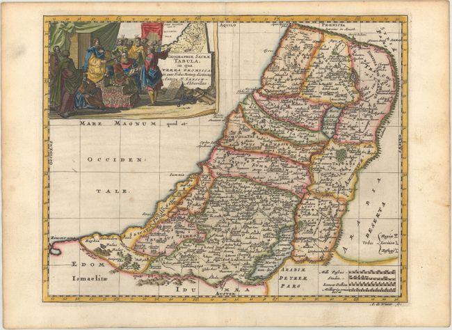
"Geographiae Sacrae Tabula, in qua Terra Promissa in Suas Tribus Partesq. Distincta", Sanson, Nicolas
Subject: Holy Land
Period: 1705 (published)
Publication: Algemeene Weereld-Beschryving...
Color: Hand Color
Size:
9.9 x 7.8 inches
25.1 x 19.8 cm
This is a reduced version of the elder Sanson's map of the Promised Land showing the Twelve Tribes of Israel. It is decorated with a large figurative title cartouche with a group of Biblical figures gathered in front of a smaller version of the main map. Engraved by Antoine d' Winter.
This map appeared in Algemeene Weereld-Beschryving, nae de Rechte Verdeeling der Landschappen, Plaetsen, Zeeën, Rivieren, &c. Geographisch, Politisch, Historisch, Chronologisch en Genealogisch, a Dutch edition of A. Phérotée de la Croix's Nouvelle Methode Pour Apprendre Facilement la Geographie Universelle, which first appeared in 1690. The Dutch edition was published by Francois Halma and included 98 maps and views.
References:
Condition: B+
A dark impression on paper with a coat of arms watermark, minor offsetting, very light soiling, and light toning along the edges of the sheet.