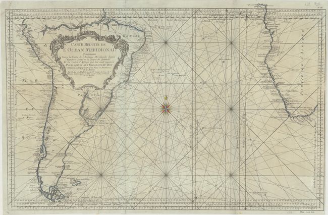
"Carte Reduite de l'Ocean Meridional Contenant Toutes les Costes de l'Amerique Meridionale depuis l'Equateur … les Costes d'Afrique qui leur sont Opposees…", Bellin, Jacques Nicolas
Subject: South Atlantic
Period: 1753 (dated)
Publication: Hydrographie Francoise…
Color: Hand Color
Size:
33.1 x 21.7 inches
84.1 x 55.1 cm
This handsome sea chart of the Southern Atlantic includes a near complete South American continent (south of the Amazon River) and southern Africa. Detail is largely confined to the coastlines. Rhumb lines and a large compass rose make this a very attractive large chart. The Prime Meridian is shown through l'Isle de Fer, I'Isle de Teneriffe, London, and Paris. The Falkland Islands are named as Isles Nouvelles, and the amorphous coast contains a note in French that it is not yet known. Price of the chart is noted as Prix. Trente Sols beneath the neatline.
References:
Condition: B
On sturdy bluish paper with a small, archivally repaired chip at top left just touching the map border along with several small edge tears and fold separations that have also been repaired on verso with archival materials. There is light toning at left and right.