Catalog Archive
Auction 167, Lot 228

"Curacao Eylandt", de Laet, Joannes
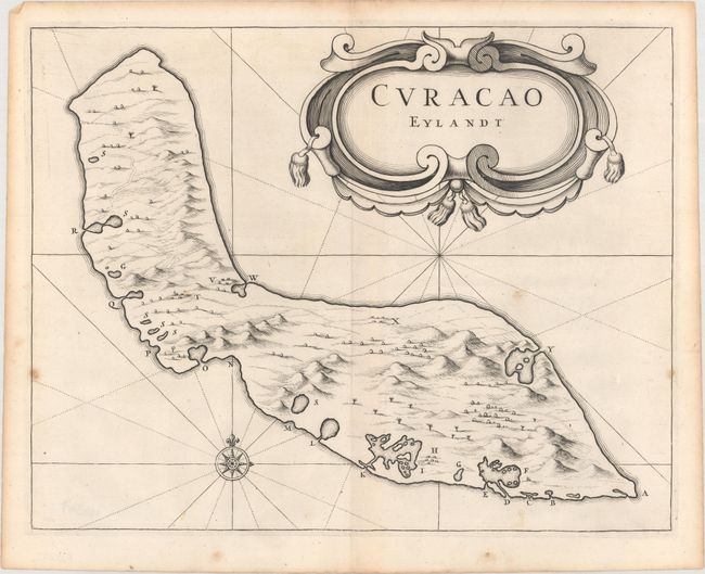
Subject: Curacao

Period: 1644 (published)

Publication: Historie ofte Iaerlijck Verhael van de Verrichtinghen...West-Indische Compagnie

Color: Black & White

Size:
13.2 x 10.4 inches
33.5 x 26.4 cm
Download High Resolution Image
(or just click on image to launch the Zoom viewer)

This is a markedly rare map of the island of Curacao, the historical nexus of the Netherlands Antilles. The island, with its large and protected natural port, was the major center for commerce of the Dutch West India Company. As a director of the newly formed Dutch West India Company, De Laet had access to much of the cartographic work and manuscript material done at the time, including the work of Hessel Gerritsz, the official cartographer of the Company. His map shows the island with nice topographical detail and features an ornate title cartouche. Published in de Laet's account of the history of the Dutch West India Company from its beginnings to 1636. We have only seen this extremely scarce map listed in dealer or auction catalogs a few times.

References: Phillips (Atlases) #3647 432-433.

Condition: B+

A fine impression on a watermarked sheet with a few spots of foxing and a light, horizontal extraneous crease at center.

Estimate: $1,600 - $1,900

Sold for: $900

Closed on 3/28/2018

Archived