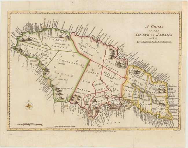
"A Chart of the Island of Jamaica, with Its Bays, Harbours, Rocks, Soundings, &c.", Bew, John
Subject: Jamaica
Period: 1780 (published)
Publication: Political Magazine
Color: Hand Color
Size:
14.6 x 10 inches
37.1 x 25.4 cm
This striking map of Jamaica is divided into the counties of Cornwall, Middlesex, and Surry and subdivided further into a number of parishes. The map is teeming with detail along the coasts, with a myriad of bays, rivers, harbors, cliffs, coves, and the like named. In the water, reefs, anchorages, and soundings are shown. There is considerably less detail inland, although many mountains are depicted, including the Blue Mountains. A compass rose capped with a fleur-de-lis appears at bottom left. Engraved by John Lodge.
References: Jolly #POL-10.
Condition: A
A crisp impression on paper with a large coat of arms watermark. Issued folding and now flattened with faint offsetting and one tiny, archivally repaired hole in an unengraved are of the image. A binding trim at right has been professionally replaced with old paper.