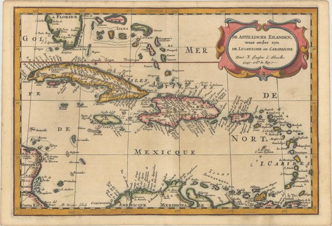
"De Antillische Eilanden, waar Onder Zyn de Lucaysche en Caribesche", Sanson, Nicolas
Subject: Caribbean
Period: 1705 (published)
Publication: Algemeene Weereld-Beschryving...
Color: Hand Color
Size:
12 x 8.2 inches
30.5 x 20.8 cm
Attractive map covering the southern tip of Florida and all of the Caribbean islands. There is good detail, especially on Cuba and Hispaniola, which display numerous place names and mountains in profile. Engraved by Antoine d'Winter.
This map appeared in Algemeene Weereld-Beschryving, nae de Rechte Verdeeling der Landschappen, Plaetsen, Zeeën, Rivieren, &c. Geographisch, Politisch, Historisch, Chronologisch en Genealogisch, a Dutch edition of A. Phérotée de la Croix's Nouvelle Methode Pour Apprendre Facilement la Geographie Universelle, which first appeared in 1690. The Dutch edition was published by Francois Halma and included 98 maps and views.
References:
Condition: A
A crisp impression with minor marginal soiling and light toning along the edges of the sheet.