"[Lot of 3] Map of Oklahoma Territory... [and] Map of Oklahoma Territory. From the Corrected Map of the General Land Office of 1898... [and] Map of Oklahoma Territory...", General Land Office
Subject: Oklahoma
Period: 1898-1903 (dated)
Publication:
Color: Printed Color
Size:
21.9 x 14.2 inches
55.6 x 36.1 cm
A nice set of GLO maps that show the rapid development of Oklahoma Territory over a five year period.
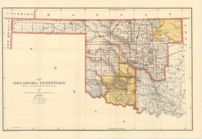
A. Map of Oklahoma Territory, 1898. A good map of the western part of the present state of Oklahoma that also includes a portion of the steadily shrinking Indian Territory. The lands of the Kiowa, Comanche and Apache are depicted in yellow at the bottom; at the top, tribal holdings of the Osage, Ponca, Kansas, Otoe and Missouri are also colored yellow. Army posts are marked in red -- Ft. Sill, Ft. Reno and the Wood Res. Railroads, public roads and trails are identified by symbols shown in the legend. Land Offices are located at Woodward, Alva, Enid, Perry, Guthrie, Kingfisher, Ft. Reno, Oklahoma City, and Mangum.
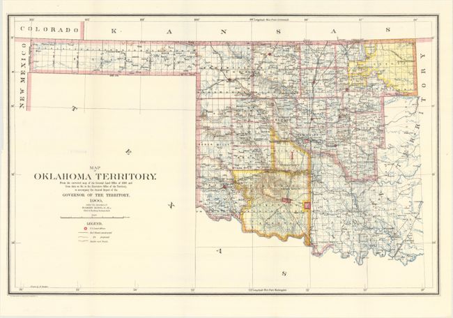
B. Map of Oklahoma Territory. From the Corrected Map of the General Land Office of 1898..., 1900. Very similar to the above map with the addition of the Chicago-Rock Island railroad cutting through the land of the Kiowa, Comanche and Apache at bottom.
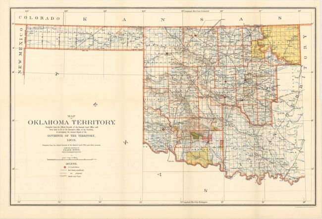
C. Map of Oklahoma Territory..., 1903. As compared to the previous map, this version presents a rapid decline in Indian lands in the south with only "Grazing Lands" identified. The railroad network in the western part of the territory continues to expand rapidly. The large reservations in the northeastern portion of the territory are still intact.
References:
Condition: A
Clean and colorful examples, issued folding. The 1898 and 1903 maps have just a hint of offsetting.