Catalog Archive
Auction 167, Lot 179

"Map of Cleveland and Ohio City Both Incorporated in 1836",

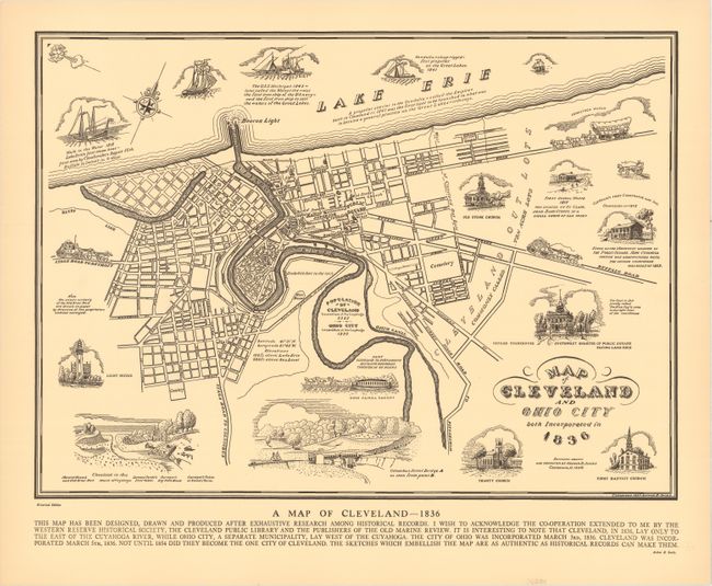
Subject: Cleveland, Ohio

Period: 1937 (dated)

Publication:

Color: Black & White

Size:
18.8 x 13.6 inches
47.8 x 34.5 cm
Download High Resolution Image
(or just click on image to launch the Zoom viewer)

This historical map shows the site of present-day Cleveland, Ohio in 1836. At that point in time, Cleveland lay only to the east of the Cuyahoga River while Ohio City lay to its west. These two localities would merge together in 1854 (as Cleveland). The map presents these two cities in street-grid pattern with some of the more important buildings identified. Surrounding the map are a series of illustrations including a stage road to Detroit, light house, Cleveland in 1800, Trinity Church, a Conestoga Wagon, and more. Created by Arthur B. Suchy, who also produced Cayo Hueso Key West Florida, which is available in the current auction.

References:

Condition: A+

A clean, crisp example.

Estimate: $140 - $170

Sold for: $85

Closed on 3/28/2018

Archived