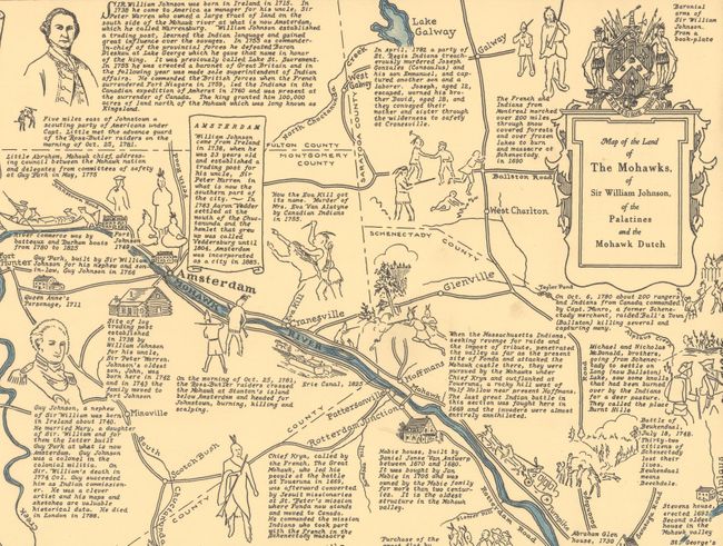
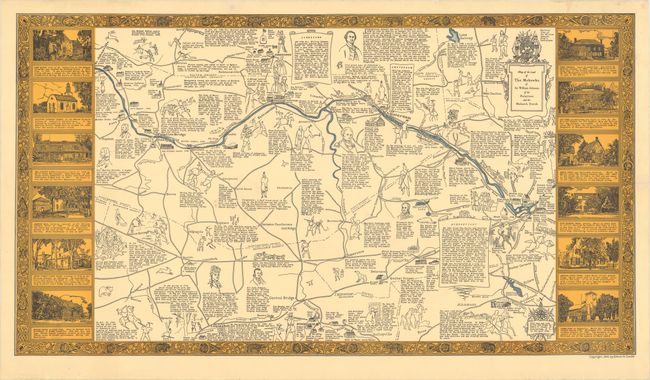
"Map of the Land of the Mohawks, of Sir William Johnson, of the Palatines and the Mohawk Dutch",
Subject: Eastern New York
Period: 1932 (dated)
Publication:
Color: Printed Color
Size:
33.4 x 18.4 inches
84.8 x 46.7 cm
This unusual map shows the turbulent history between the Mohawk Indians and European settlers in this region of eastern New York. The map covers the area from Scotia, Amsterdam, and Fort Plain along the Mowhawk River to points south including Cobleskill and Schoharie. Numerous illustrations and notations fill the map and highlight important people, events, and battles. Included is a summary of the contributions of William Johnson and historical overviews of Johnstown, Amsterdam, and Schenectady. A sampling of illustrations include the Schnectady Massacre, Battle of Stone Arabia, and the martyrdom of Father Isaac Joques. The map is surrounded by a decorative border featuring a dozen notable buildings. Compiled and drawn by Edwin Conde in 1931 and copyrighted in 1932.
References:
Condition: A
A clean, bright example. Professionally backed with tissue to repair an edge tear at right that extends just 1.5" into the decorative border.