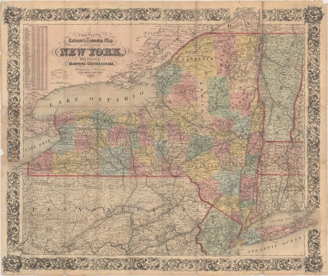
"Colton's Railroad & Township Map of the State of New York, with Parts of the Adjoining States & Canada", Colton, Joseph Hutchins
Subject: New York
Period: 1853 (dated)
Publication:
Color: Hand Color
Size:
29.1 x 24.4 inches
73.9 x 62 cm
This large pocket map, printed on banknote paper, is dated 1852 in the copyright notice, but this example is updated to 1853, as indicated in the title. Counties are delineated with information on villages, towns, roads, canals, and a large number of named railroads. A table of "Statistics of Population" at upper left shows a population of over 3 million people in 1850. Decorated with a wide and elaborate floral border. The map was drawn by George W. Colton and engraved by J. M. Atwood. Boards not present with this example.
References:
Condition: B+
A nice example with minor toning along a few folds at top and at far left where the map was originally attached to the boards. (Boards not present with this example.) There are a number of short separations at fold intersections and three 2" separations that have been closed on verso with archival tape.