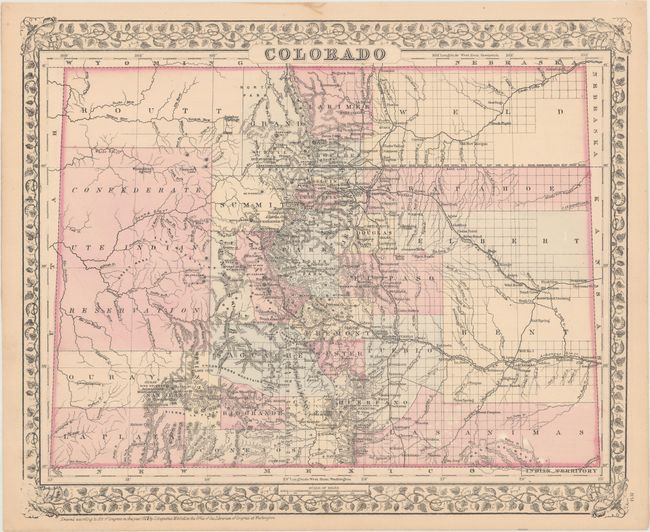
"Colorado", Mitchell, Samuel Augustus
Subject: Colorado
Period: 1879 (dated)
Publication:
Color: Hand Color
Size:
14.3 x 11.8 inches
36.3 x 30 cm
This fine map shows the status of settlement and development three years after Colorado became a state. It details railroads, cities, towns and mining communities, watershed, forts, and more. The large Confederate Ute Indian Reservation takes up a majority of the western part of the state. Features good topographical detail in hachure. This is one of the few Mitchell atlas map years showing Colorado separately. Indian Territory on verso.
References:
Condition: A
There is a tiny stain in the top blank margin and a hint of toning along the sheet edges.