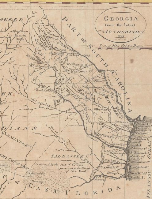
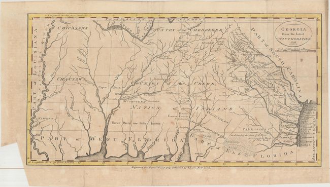
"Georgia from the Latest Authorities", Payne, John
Subject: Southern United States
Period: 1799 (dated)
Publication: New and Complete System of Universal Geography...
Color: Hand Color
Size:
15.1 x 7.9 inches
38.4 x 20.1 cm
This uncommon map covers the region from the Atlantic seaboard to the Mississippi River, including present-day Georgia, Alabama and Mississippi. There is good topographical information, particularly for the eastern section near the coast. Early counties in Georgia are named and their boundaries given. The interior is labeled Country of the Creek Nation of Indians with several other tribes located and the notation "These Parts are little known." Several trading paths to the interior are shown. This is a re-engraving based upon earlier maps by Tanner in 1796 and Carey in 1795.
References: Wheat & Brun #619.
Condition: B
Issued folding with light toning, scattered foxing, and a chip confined to the lower left blank margin. A 4" tear and a few small fold separations have all been closed on verso with archival tape.