Catalog Archive
Auction 166, Lot 606

Rare and Decorative Map of Malta

"Carte et Plan de l'Isle de Malthe et des Villes et Forts avec les Nouvelles Fortiffications Ainsy quelle sont Apresent", Beaulieu, Sebastian de Pontault
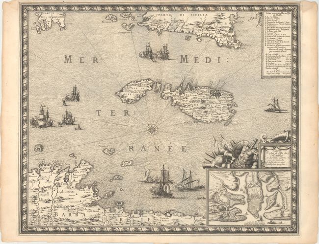
Subject: Malta

Period: 1680 (circa)

Publication:

Color: Black & White

Size:
21.2 x 17.5 inches
53.8 x 44.5 cm
Download High Resolution Image
(or just click on image to launch the Zoom viewer)

This rare and decorative map of Malta is by Sebastian de Pontault Beaulieu, a French military engineer best known for his battle plans. The map depicts sea battles to the north, west, and south of the island, with a single galley to the east. It extends to show the southernmost parts of Sardinia and Sicily and a stretch of northern Africa, including both Tunis and Tripoli. An inset at bottom right zooms in on Valletta and its surroundings, with a key at top right that identifies 17 locations of note, including the many fortifications in the area. The key also notes distances between different destinations. Flanking the inset and title cartouche are symbols of military might. The map is surrounded by a decorative border.

References:

Condition: B+

A dark impression on watermarked paper with faint damp stains that just enter the border at top, and some small worm holes in the blank margins.

Estimate: $1,600 - $1,900

Sold for: $1,000

Closed on 2/14/2018

Archived