Catalog Archive
Auction 166, Lot 466

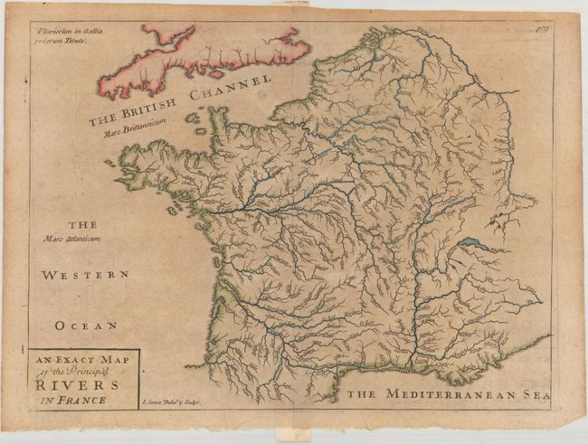
"An Exact Map of the Principal Rivers in France", Cluver, Philipp

Subject: France

Period: 1711 (published)

Publication: Introductio in Universam Geographiam

Color: Hand Color

Size:
11.4 x 8.5 inches
29 x 21.6 cm
Download High Resolution Image
(or just click on image to launch the Zoom viewer)

This map focuses on the system of rivers and canals in France. The map was published in Philipp Cluver's Introductio in Universam Geographicam, a popular atlas that appeared in over 45 editions during a 100-year period. The first edition was published without maps in the 1620s, and the first edition to include maps was published circa 1641. The various editions were published in different cities throughout Europe, including Amsterdam, Nuremberg, and London. This map is from a London edition, with the majority of the maps re-engraved by John Senex.

References: Shirley (BL Atlases) T.CLUV-9a #6.

Condition: B+

Light toning with a few minor printer's creases at bottom.

Estimate: $80 - $100

Sold for: $40

Closed on 2/14/2018

Archived