Catalog Archive
Auction 166, Lot 250

"A Plan of the Town and Chart of the Harbour of Boston Exhibiting a View of the Islands Castle Forts and Entrances Into the Said Harbour", Anon.

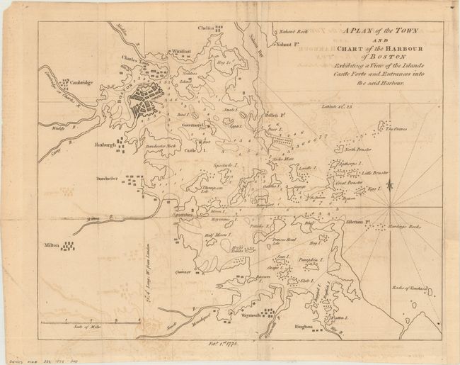
Subject: Boston, Massachusetts

Period: 1775 (dated)

Publication: Gentleman's Magazine

Color: Black & White

Size:
13.2 x 10.4 inches
33.5 x 26.4 cm
Download High Resolution Image
(or just click on image to launch the Zoom viewer)

This attractive copper engraved map of the greater Boston area was issued just prior to the first hostilities of the American Revolution. The map focuses on the islands in the harbor with soundings, hazards and shipping lanes carefully delineated. Among the towns located on the map are Chelsea, Cambridge, Dorchester, Milton, and Weymouth. Several maps of Boston and the surrounding area appeared in English magazines during 1774-75 as Boston became the hot spot of resentment against British taxation and rule. This map was issued just a few months before the defining conflicts at Lexington and Concord.

References: Jolly #GENT-232.

Condition: B

Issued folding and now flattened and backed with tissue to reinforce and repair several minor fold separations and one tiny hole in an unengraved area of the map. Light offsetting with a binding trim at lower right that has been replaced with old paper.

Estimate: $250 - $325

Sold for: $350

Closed on 2/14/2018

Archived