Catalog Archive
Auction 166, Lot 23

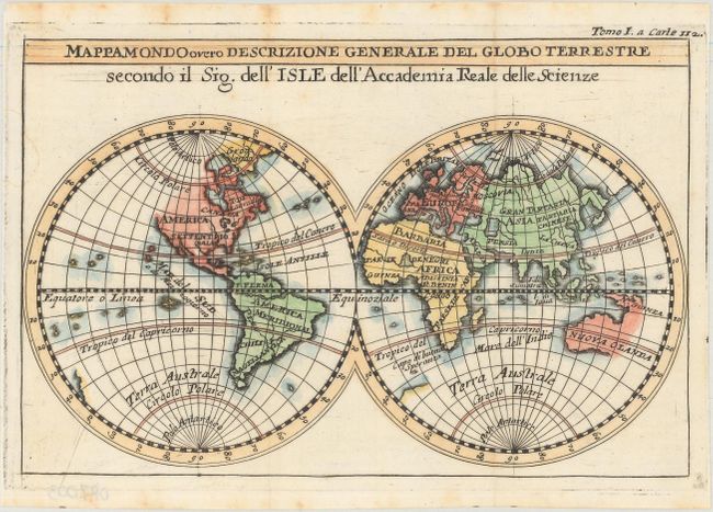
"Mappamondo Overo Descrizione Generale del Globo Terrestre Secondo il Sig. dell' Isle dell' Accademia Reale delle Scienze",

Subject: World

Period: 1720 (circa)

Publication: La Scienza delle Persone di Corte, di Spada, e di Toga

Color: Hand Color

Size:
8.2 x 5.4 inches
20.8 x 13.7 cm
Download High Resolution Image
(or just click on image to launch the Zoom viewer)

This charming double-hemisphere world map locates only a few key place names within each continent and depicts only major rivers and lakes. A small remnant of the great southern continent remains south of Africa. The northwest coast of North America is left blank, and only the western coast of New Zealand is shown. Australia is also only depicted in part, and is shown connected to New Guinea. This map appeared in La Scienza delle Persone di Corte, di Spada, e di Toga, which was published by M. de Chevigny and Henri Philippe de Limiers.

References:

Condition: A

A sharp impression, issued folding, with some light stains almost entirely confined to the blank margins.

Estimate: $120 - $150

Sold for: $90

Closed on 2/14/2018

Archived