Catalog Archive
Auction 166, Lot 235

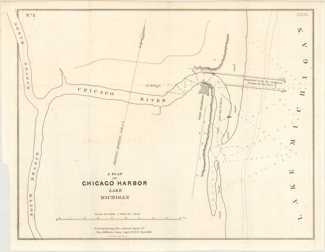
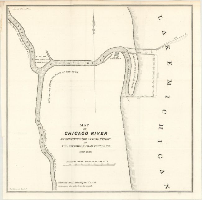
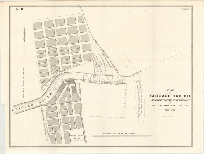
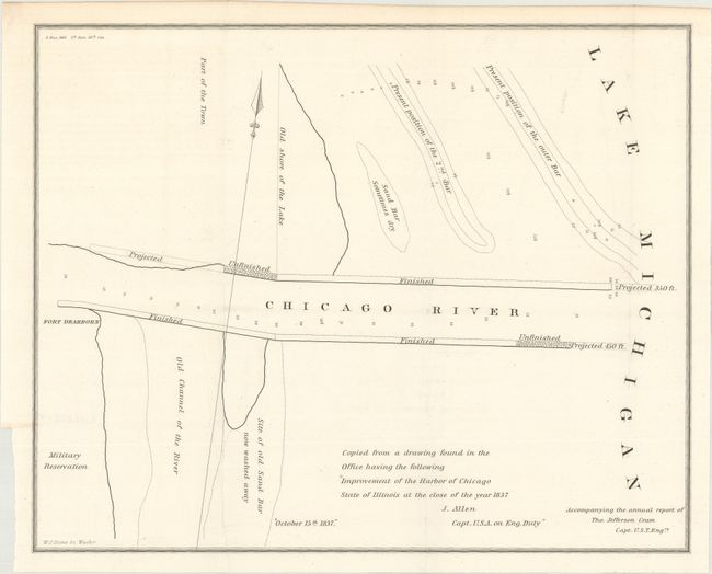
Four Early and Rare Maps of Chicago

"[Lot of 4] A Plan of Chicago Harbor Lake Michigan [and] Map of Chicago Reader... [and] Plan of Chicago Harbor... [and] [Copy of "Improvement of the Harbor of Chicago State of Illinois at the Close of the Year 1837]",

Subject: Chicago, Illinois

Period: 1839 (dated)

Publication: Sen. Doc. 140., 26th Congress, 1st Session

Color: Black & White

Size:
See Description
Download High Resolution Image
(or just click on image to launch the Zoom viewer)

These four maps of Chicago were originally issued in the 26-page Report from the Secretary of War, Transmitting Copies of Reports of the Topographical Bureau in Relation to Internal Improvements in the Territory of Wisconsin..., the report of Captain Thomas Jefferson Cram of the Topographical Engineers. Cram (1804-1883) was born in New Hampshire and graduated fourth in his class from the United States Military Academy in West Point, New York. In 1838, he joined the U. S. (Army) Topographical Engineers, where he received a captain's commission and was assigned to the Great Lakes harbor surveys. In the 1840s he surveyed the Michigan and Wisconsin boundary, and in 1855 he became Chief of the Topographical Engineers, Western Division. He was promoted to Lt. Colonel in 1861, served with distinction in the Civil War and was rewarded with the title of Brevet General in 1866. He retired in 1869.

A. A Plan of Chicago Harbor Lake Michigan (14.9 x 11.3"). This is the earliest map of Chicago harbor that we have seen, when the population of the entire city was about 4500. Fort Dearborn, the first recognized structure of Chicago, and Dr. Wolcott's residence are the only two buildings located. Soundings are noted in the Chicago River and Lake Michigan.

B. Map of Chicago River Accompanying the Annual Report... (10.7 x 10.9"). This is one of the earliest printed maps to focus on the vicinity of Chicago. It shows the Chicago River and a sand spit jutting into Lake Michigan noted as "now washed away." Fort Dearborn, a light house, the Site of the Business Part of the Town, and the Site of the Proposed Canal Basin are located.

C. Plan of Chicago Harbor Accompanying the Annual Report... (14.0 x 10.9"). Another early map of Chicago, this one zoomed in to the Harbor. Part of the city is shown in plan form, and several streets are named. An area south of Randolph Street is Public Ground for ever to remain vacant. The map identifies Fort Dearborn and a lighthouse by the bend of the Chicago River. It also depicts the position of the pier and of the shore as they existed on September 1st, 1839.

D. [Improvement of the Harbor of Chicago State of Illinois at the Close of the Year 1837] (11.9 x 9.6"). This untitled map of where the Chicago River meets Lake Michigan was apparently copied from "a drawing found in the Office" made by Captain J. Allen in 1837. In a spare style it shows the old shore of the lake, an old channel of the river, sand bars, a military reservation, Fort Dearborn, and finished, unfinished, and proposed sections of the harbor.

References: Claussen & Friis #330-33.

Condition: A

Issued folding on bright sheets with just a hint of offsetting.

Estimate: $1,200 - $1,500

Sold for: $750

Closed on 2/14/2018

Archived