Catalog Archive
Auction 166, Lot 16

"Totius Orbis Terrarum Tabula, Ejusque Post Diluvium Divisio Inter Filios Noachi", Moxon, Joseph
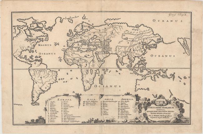
Subject: World

Period: 1671 (circa)

Publication:

Color: Black & White

Size:
12.8 x 8.1 inches
32.5 x 20.6 cm
Download High Resolution Image
(or just click on image to launch the Zoom viewer)

This interesting and unusual world map is from an English Bible designed to illustrate how the world was divided among the sons of Noah. The map is presented on Mercator's projection, with Europe, Africa, and Asia at the center and South America with a part of North America at left. The island of California is placed at the extreme right of the map, and a Northwest Passage seems entirely probable. This map has practically no detail other than rivers and mountain ranges, except for a tiny engraved depiction of the Garden of Eden located just south of the Caspian Sea. A large table at bottom provides a numeric key to major locations throughout the world. The title cartouche includes a scene of Noah's Ark and the Great Flood. Shirley dates the map 1671, but alludes that the map may possibly be of later date and published by one of the younger members of the family.

References: Shirley #458.

Condition: B

There is minor soiling, a tiny rust spot near Burma, and some extraneous creasing. The map has been professionally backed with old paper to repair and reinforce a 2" tear near the center of the image.

Estimate: $240 - $300

Sold for: $180

Closed on 2/14/2018

Archived