Catalog Archive
Auction 165, Lot 616

Pirated Edition of Blaeu's Map of the Turkish Empire with Interesting Erasures

"Turcicum Imperium", Blaeu, (Family)

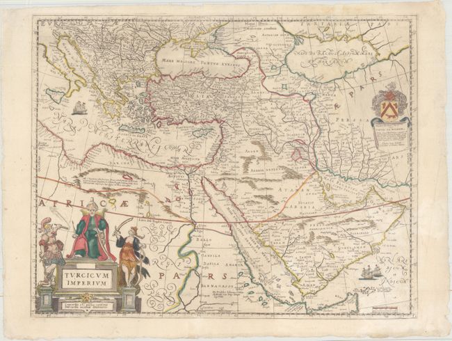
Subject: Eastern Mediterranean & Middle East

Period: 1680 (circa)

Publication:

Color: Hand Color

Size:
20.1 x 15.8 inches
51.1 x 40.1 cm
Download High Resolution Image
(or just click on image to launch the Zoom viewer)

This is a pirated edition of Blaeu's map of the Turkish Empire at the height of its power. The region it covers is from the Balkans to Persia and from Northern Africa through the Arabian Peninsula. It is embellished with a fine cartouche showing the Turkish Sultan on his throne and allegorical figures at either side brandishing weapons. A second cartouche contains the coat of arms and dedication to David de Wilhem, a Dutch patrician who traveled in Egypt, Palestine and Syria in the 1620s. Sailing ships can be seen in the Mediterranean and Arabian Seas. This map was published anonymously by Pietro Todeschi, who specialized in reprinting maps by Dutch masters. Although a close copy of Blaeu's original, the engraving style on this pirated edition is clearly inferior. Interestingly, the plate that was used for this map had clearly been previously used for a completely different map, as is evidenced by the partial erasures that are visible throughout the map (and particularly noticeable in the Caspian Sea and the Gulf of Aden).

References:

Condition: A

A clean and bright example on watermarked paper with deckled edges and a few very faint stains.

Estimate: $475 - $600

Sold for: $425

Closed on 11/15/2017

Archived