Catalog Archive
Auction 165, Lot 469

NO RESERVE

"Trier et Lutzeborg", Mercator/Hondius

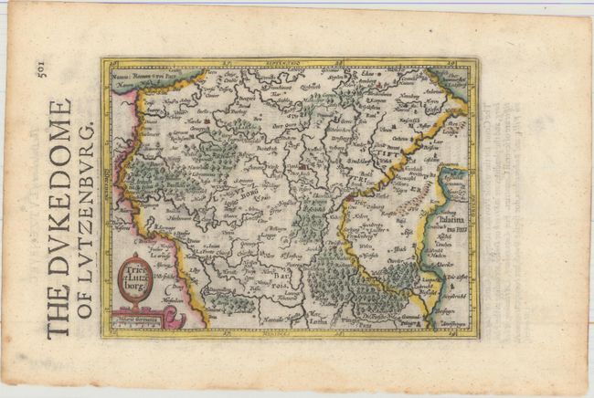
Subject: Luxembourg & Western Germany

Period: 1635 (published)

Publication: Historia Mundi or Mercators Atlas...

Color: Hand Color

Size:
7.2 x 5.4 inches
18.3 x 13.7 cm
Download High Resolution Image
(or just click on image to launch the Zoom viewer)

This handsome small map is roughly centered on the city of Luxembourg, with Trier just to the northeast. Numerous small towns are depicted, along with the key rivers in the region, including the Moselle River.

This map comes from the English edition of Mercator's Atlas Minor, which was published under the title Historia Mundi or Mercators Atlas by Michael Spark and Samuel Cartwright. After acquiring the plates to the 1607 edition of the Mercator/Hondius Atlas Minor, Sparke republished the maps with text translated into English by Wye Saltonstall. Sparke also had 41 additional maps engraved for the Historia Mundi. Most of these maps were copied from Cloppenburg's edition of Atlas Minor and are therefore a bit larger, with some signed by the engravers Jacob van Langren and Ralph Hall. These additional maps only appeared in the 1635, 1637 and 1639 editions of the Historia Mundi and are therefore quite scarce.

References: Van der Krogt (Vol. III) #2430:351.

Condition: A

A sharp impression on watermarked paper with several minor extraneous creases and light toning along the edges of the sheet.

Estimate: $100 - $130

Sold for: $41

Closed on 11/15/2017

Archived