Catalog Archive
Auction 165, Lot 359

"Plan de la Baye et de la Ville de St. Louis, dans la Partie du Sud de l'Isle de St. Domingue...", Phelipeaux, Rene (Sieur)

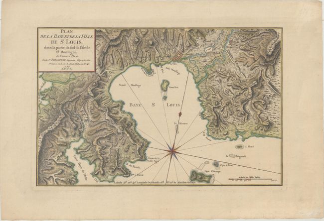
Subject: Saint-Louis-du-Sud, Haiti

Period: 1786 (dated)

Publication:

Color: Hand Color

Size:
14.8 x 9.6 inches
37.6 x 24.4 cm
Download High Resolution Image
(or just click on image to launch the Zoom viewer)

This scarce map is centered on Saint Louis Bay located on the southern coast of present-day Haiti. The map shows the city of Saint-Louis-du-Sud in block plan format, as well as the "old fort" (Fort Saint Louis) on an island in the bay. There is excellent detail of the surrounding topography, with many roads and villages also shown.

References:

Condition: A

A sharp impression on watermarked paper with light marginal soiling.

Estimate: $275 - $350

Sold for: $200

Closed on 11/15/2017

Archived