Catalog Archive
Auction 165, Lot 311

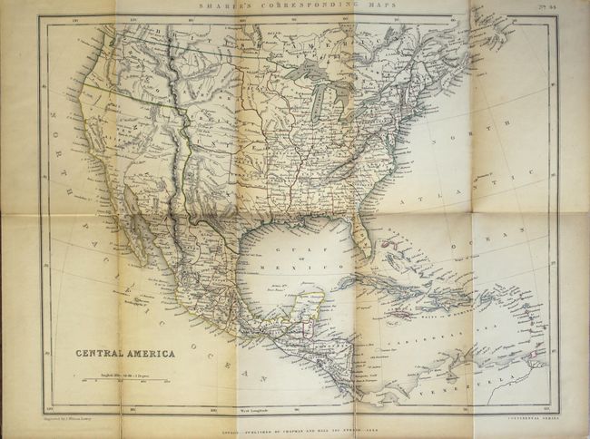
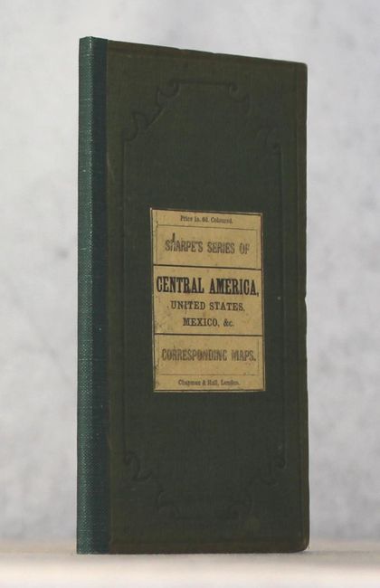
"Central America", Chapman & Hall

Subject: United States, Mexico & Central America

Period: 1848 (dated)

Publication:

Color: Hand Color

Size:
16 x 12.6 inches
40.6 x 32 cm
Download High Resolution Image
(or just click on image to launch the Zoom viewer)

Despite its title, this pocket map covers the entire United States and extends south to include Mexico and Central America. The new state of Texas is shown in its large stovepipe configuration, while Mexico is still in control of California and the Southwest. Present-day Oklahoma is named Western Territory and a huge Nebraska Territory occupies the region between the Rockies and the Missouri River. An undivided Dacota Iowa Territory takes up the region between the Missouri and Mississippi rivers. The map shows good detail of forts, settlements, rivers and topography. The map has been backed with linen and folds into green cloth boards (4.0 x 7.2") with paper label on front cover. We could not find any past auction results or dealer listings for the pocket version of this map.

References:

Condition: B

The map, in original outline color, is lightly toned with several short fold separations that have been closed with linen on verso. Covers are lightly worn with cloth reinforcement on spine.

Estimate: $275 - $350

Sold for: $100

Closed on 11/15/2017

Archived