Catalog Archive
Auction 165, Lot 309

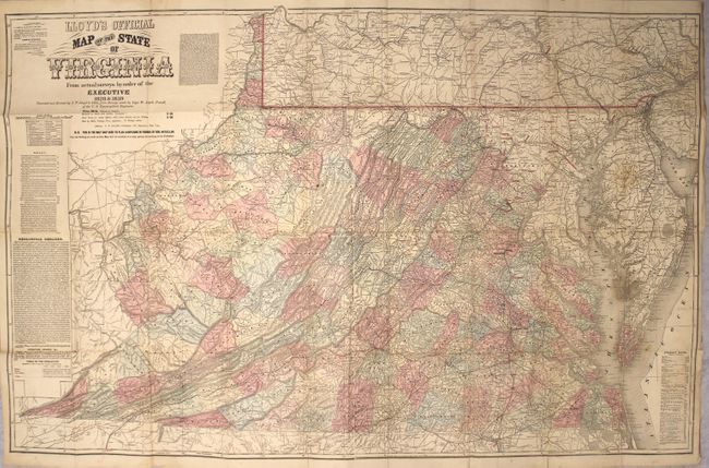
Rare London Issue of Lloyd's Civil War Map of Virginia with Racist Commentary

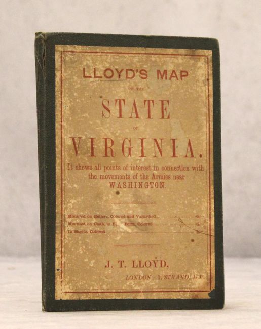
"Lloyd's Official Map of the State of Virginia from Actual Surveys by Order of the Executive 1828 & 1859...", Lloyd, James T.

Subject: Virginia

Period: 1862 (dated)

Publication:

Color: Hand Color

Size:
47.1 x 30.3 inches
119.6 x 77 cm
Download High Resolution Image
(or just click on image to launch the Zoom viewer)

This scarce, large-scale folding map depicts Virginia during the Civil War, and was based on the Boye-Bucholtz four-sheet map of 1859. Originally published as a nine-sheet map in 1827, the Boye-Bucholtz map of Virginia was a landmark in its time, being "the largest and finest map of the state produced in the nineteenth century," according to Wooldridge. The surveying, drafting and engraving took a decade of work and $80,000 to complete and resulted in a map that was nearly forty square feet in size. A reduced-size version was also authorized, which appeared in 1859 and served as the basis for Lloyd's map of the state. Of course when Lloyd first published his edition in 1861, he marketed it as "Lloyd's $100,000 Topographical Map of Virginia Used by the War Department." And although the title of the map was "Lloyd's Official Map of the State of Virginia," the map had not been granted any official status by the state government.

Lloyd's map underwent several editions with varying text and advertisements surrounding the map, including this updated edition in 1862 based on surveys made by W. Angelo Powell of the U.S. Topographical Engineers. This edition also includes a note below the title stating that: "This is the only map used to plan campaigns in Virginia by General McClellan." At left are geological remarks describing the rock and soil formations that are found in different areas of the state. Below the geological remarks is a table listing the white, slave and free black populations of the state in 1790, 1800, 1810, and 1859, showing the dramatic growth of the state.

One of the most fascinating and unusual elements of this map is the commentary to the right of the title, which condemns the Burnet House (a hotel) in Cincinnati, Ohio, due to its inhospitable proprietor, an avid gambler, and its indecent employees, who regularly harass women. After a lengthy description of the improper behaviors of those associated with the hotel, the note also chastises a Philadelphia hotel: "owned by Boston negro worshiping abolitionists, who, thinking a negro better than a white person, attempted on the 1st of January to set a 'culled pussun' at their table, which so enraged the guests that they left the house." The note ends with: "Let the seal of public contempt be put upon such houses and their ungentlemanly conductors." It is a little odd that the map would caution readers against a hotel in Cincinnati, Ohio, however it is more fitting that the publisher would mention the hotel in Philadelphia, which is shown in the map at top right, particularly in light of Virginia's recent secession from the Union.

The map itself is filled with detail, including counties, towns, roads, rivers, and topographical detail. The map extends to include all of Maryland and southern Pennsylvania. Railroad lines are depicted throughout most of Virginia, including the Richmond and Lynchburg; the Richmond and Danville; the Orange and Alexandria; and the Virginia and Tennessee. Many of these rail lines were indispensable during the Civil War. Also identified are mills, factories, iron works, forts, batteries, colleges and houses of worship. This edition was issued mounted on linen and folds into dark green cloth-covered self-wrappers. The front cover of the wrappers has a printed title label indicating that the map "shows all the points of interest in connection with the movements of the Armies near Washington" and includes the imprint "J. T. Lloyd, London: 1, Strand, W.C." It is likely that printed copies of the map were sent to London to be sold to the British public, who were closely following the American Civil War.

References: Wooldridge, pp. 257-61; cf. Stephenson #465.

Condition: B+

There are a number of short separations along the folds, as well as one 5" separation at far right. There is light soiling and numerous old manuscript markings in orange, red, and blue highlighting cities, roads, and rivers.

Estimate: $3,500 - $4,500

Sold for: $2,200

Closed on 11/15/2017

Archived