Catalog Archive
Auction 165, Lot 298

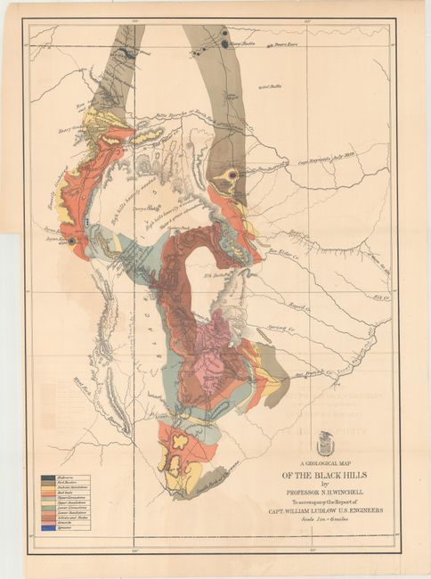
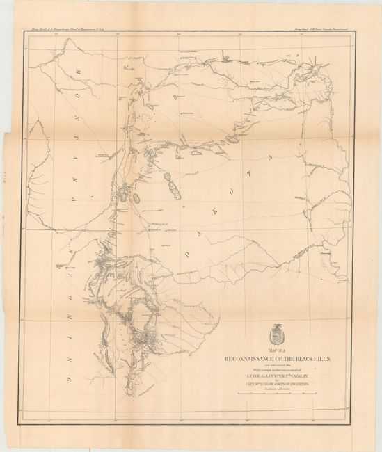
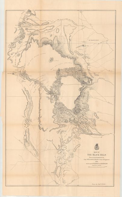
"[Lot of 3] A Geological Map of the Black Hills by Professor N.H. Winchell... [and] Map of a Reconnaissance of the Black Hills, July and August, 1874... [and] Map of the Black Hills...", U.S. Corps of Engineers

Subject: Black Hills, South Dakota

Period: 1874 (dated)

Publication:

Color:

Size:
See Description
Download High Resolution Image
(or just click on image to launch the Zoom viewer)

A nice set of three matched maps from Ludlow's report detailing Custer's Expedition into the Black Hills:

A. A Geological Map of the Black Hills by Professor N.H. Winchell to Accompany the Report of Capt. William Ludlow U.S. Engineers, printed color (17.7 x 25.3"). In the summer of 1874, Custer was tasked with reconnoitering a route to Bear Butte and exploring the vicinity. Gold was discovered, leading to a major Gold Rush and an intrusion of white prospectors into the Black Hills, which are sacred to the Sioux and Cheyenne. This led to the Battle of Little Bighorn in 1876, and thus to the end for Custer and the 7th Cavalry. A legend in the lower left indicates eleven geological types through coloring and line. This map locates numerous creeks and gives detail of timber and topography.

B. Map of a Reconnaissance of the Black Hills, July and August, 1874, with Troops Under Command of Lt. Col. G.A. Custer, 7th Cavalry..., black & white (21.3 x 25.2"). This is Ludlow's principle map that shows the entirety of Custer's reconnaissance of 1874. The map extends from Old Ft. Pierre on the Missouri River to the Little Missouri Buttes and north to the Badlands and the Yellowstone River. The map traces Custer's route through the region of the Black Hills with the date of each encampment. It contains many interesting notations, such as "Where they killed the Rees," "Where the sickman was killed" plus many comments on water, grasslands, springs, etc. The topography is nicely developed and portions of Raynold's 1859 route is shown.

C. Map of the Black Hills..., black & white (23.7 x 38.3"). A large map drawn by Sergeant C. Becker with additional geography from the maps of Warren and Raynolds. It covers the Black Hills between the Belle Fourche or North Fork of the Cheyenne River to the South Fork of the Cheyenne. Drawn on a scale of 3 miles=1 inch. Topography is nicely developed with portions of Warren's route of 1857 and that of Raynold's in 1859 shown.

References: Wheat (TMW) #1248, #1249 & #1251.

Condition: B

Issued folding with light toning, light offsetting, and several short splits at fold intersections. The geological map also has a 1.5" binding tear at left that has been closed on verso with archival tape.

Estimate: $300 - $375

Sold for: $220

Closed on 11/15/2017

Archived