Catalog Archive
Auction 165, Lot 294

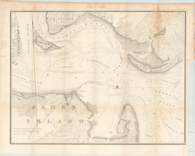
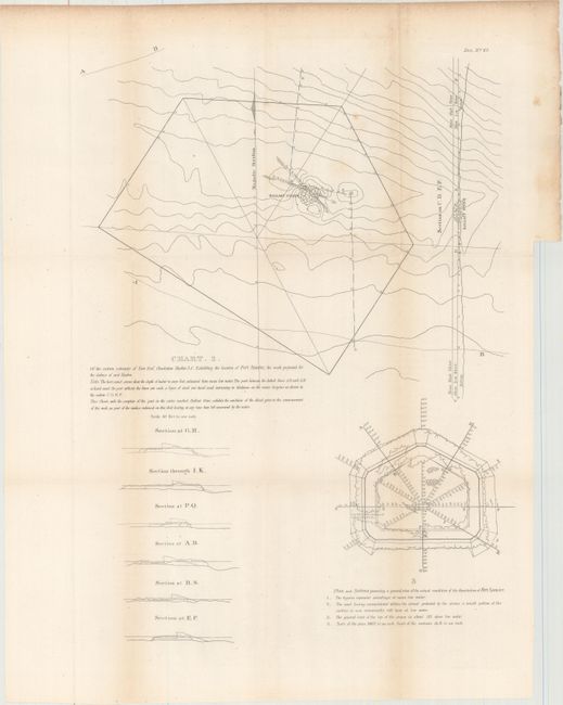
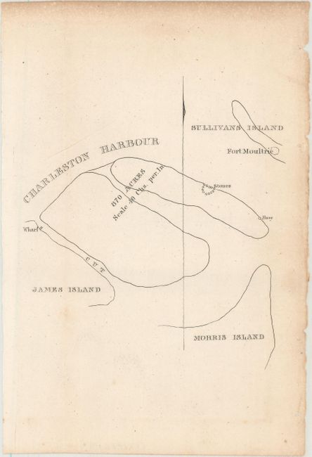
"[Lot of 4] [Untitled - Charleston Harbor] [with Report and 2 Other Charts]", U.S. War Department

Subject: Charleston, South Carolina

Period: 1835 (published)

Publication: H.R. Doc. 67, 23rd Congress, 2nd Session

Color: Black & White

Size:
23.3 x 17.8 inches
59.2 x 45.2 cm
Download High Resolution Image
(or just click on image to launch the Zoom viewer)

This uncommon, 19 page report concerns the suspension of construction of Fort Sumter in 1834, only five years after construction commenced. Of particular interest is the untitled chart showing the approaches to Charleston. Using a scale of four inches to one mile, it served as the basis for subsequent maps of the Coast Survey. A note at lower left says "The dotted lines on the bottom of the Harbour at the depth of 6,12, 18, & 24 ft below mean low water." It shows drainage, vegetation, cultivated areas, swampland, and roads. Forts Sumter, Moultrie, and Johnson are prominently featured, and nine inch circles delineate the range of their guns. Fort Sumter, with smaller guns, uses six inch lines to show their range. Also included with the report is a small sketch map of the shoal on which Fort Sumter was built (6 x 9"), and a larger folding map with more details of the planned site on the eastern extremity of Fort Reef (15 x 19"). Disbound.

References: Claussen & Friis #38, #39 and #40.

Condition: B+

The maps have light scattered foxing mostly in the blank margins and very faint offsetting. The report text has light toning and scattered foxing.

Estimate: $200 - $230

Unsold

Closed on 11/15/2017

Archived