Catalog Archive
Auction 165, Lot 278

"Soil Map Suffolk and Nassau Counties - Eastern Sheet New York", U.S.D.A.

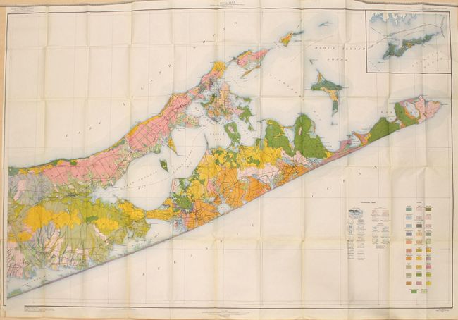
Subject: Long Island, New York

Period: 1928 (dated)

Publication:

Color: Printed Color

Size:
52.1 x 34.9 inches
132.3 x 88.6 cm
Download High Resolution Image
(or just click on image to launch the Zoom viewer)

This impressive map covers the eastern third of Long Island from Riverhead to Montauk. It presents the soils of the region through 32 different colors and shades, and the results are visually striking. The base topographical map was provided by the U.S. Geological Survey. In addition to the soil types, the map depicts roads, railroads, cities and towns, county boundaries, topography and more. This was the first year that the soil surveys moved to the Bureau of Chemistry and Soils, and was published under the direction of Henry G. Knight.

References:

Condition: B+

A clean, colorful example with a few short edge tears due to the size of the map. Only one tear at the lower left corner extends into the image (2.5") and has been closed on verso with archival tape. An otherwise near fine map.

Estimate: $140 - $170

Sold for: $100

Closed on 11/15/2017

Archived