Catalog Archive
Auction 165, Lot 257

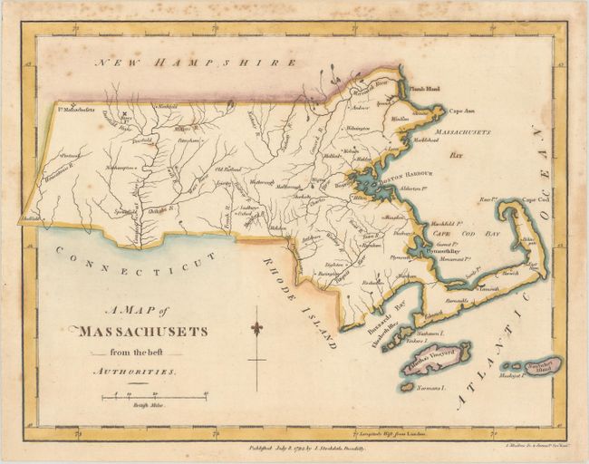
"A Map of Massachusets from the Best Authorities", Morse, Jedidiah (Rev.)
Subject: Massachusetts

Period: 1794 (dated)

Publication: The American Geography

Color: Hand Color

Size:
9.1 x 7 inches
23.1 x 17.8 cm
Download High Resolution Image
(or just click on image to launch the Zoom viewer)

This early map of the state of Massachusetts appeared in Stockdale’s London printing in 1794 of Jedidiah Morse’s rare The American Geography, containing 25 maps. Perhaps the first map of the state following the Revolutionary War, it locates many rivers, towns, and cities. Boston Harbor, Plymouth Bay, Martha's Vineyard, and Nantucket Island are all identified. Morse's American Geography is the earliest compilation of maps and descriptions regarding the early states and territories within the United States. Engraved by I. Mutlow.

References: Howes #M840; McCorkle (18th C. Geography Books) #302 [8]; Sabin #50924.

Condition: B+

A crisp impression with light scattered foxing primarily along the top border.

Estimate: $220 - $250

Sold for: $80

Closed on 11/15/2017

Archived