Catalog Archive
Auction 165, Lot 256

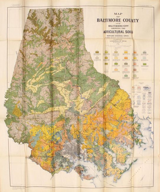
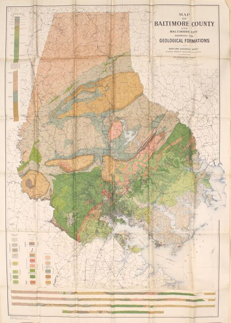
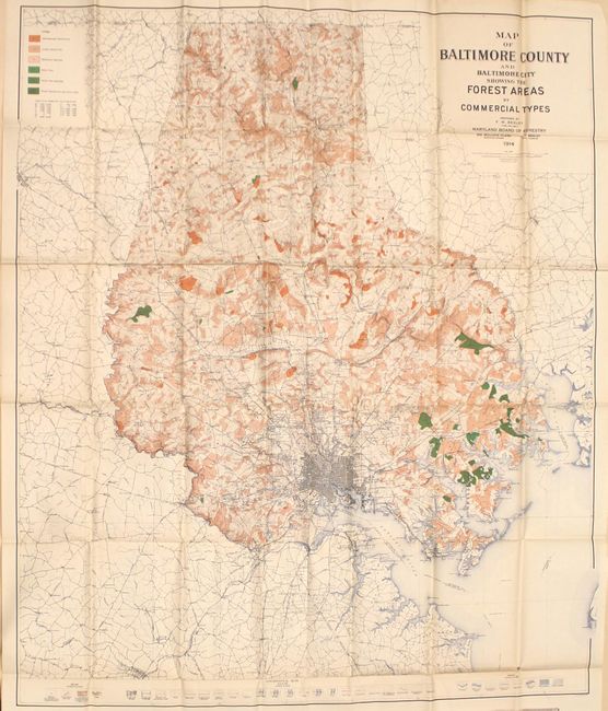
Colorful, Large-Scale Maps of Baltimore and Vicinity

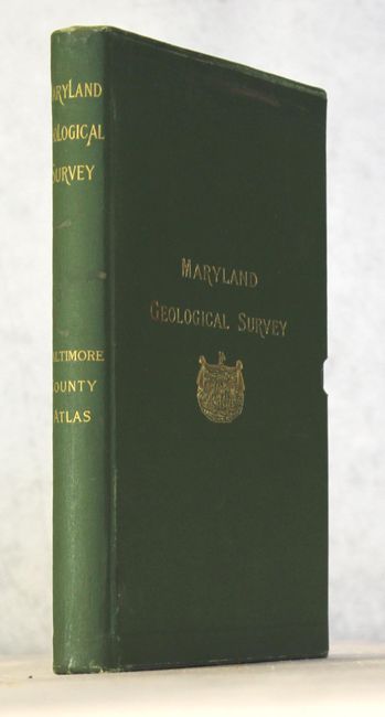
"[Lot of 3] Maryland Geological Survey - Baltimore County Atlas",

Subject: Baltimore, Maryland

Period: 1914-25 (dated)

Publication:

Color: Printed Color

Size:
7 x 10.4 inches
17.8 x 26.4 cm
Download High Resolution Image
(or just click on image to launch the Zoom viewer)

These large maps were issued as the atlas to accompany the text volume for Baltimore County issued in 1929. The maps were a partnership between the Maryland Geological Survey and the U.S. Geological Survey, and present the forests, soil profiles, and geology of the region through a combination of color and texture. The resulting visual information is both informative and attractive. The list of maps include:

A. Map of Baltimore County and Baltimore City Showing the Forest Areas by Commercial Types, dated 1914 (39.8 x 46.4").

B. Map of Baltimore County and Baltimore City Showing the Agricultural Soils, dated 1919 (32.9 x 38.6").

C. Map of Baltimore County and Baltimore City Showing the Geological Formations, dated 1925 (34.4 x 47.9").

The maps are housed in a green cloth clamshell case with gilt title on front cover and spine.

References:

Condition: B+

The maps, issued folding, are clean with vivid colors. There are numerous splits at fold intersections as is common for these large folding maps, and a few other small separations in the blank margins. Clamshell case has light wear.

Estimate: $200 - $250

Sold for: $150

Closed on 11/15/2017

Archived