Catalog Archive
Auction 165, Lot 255

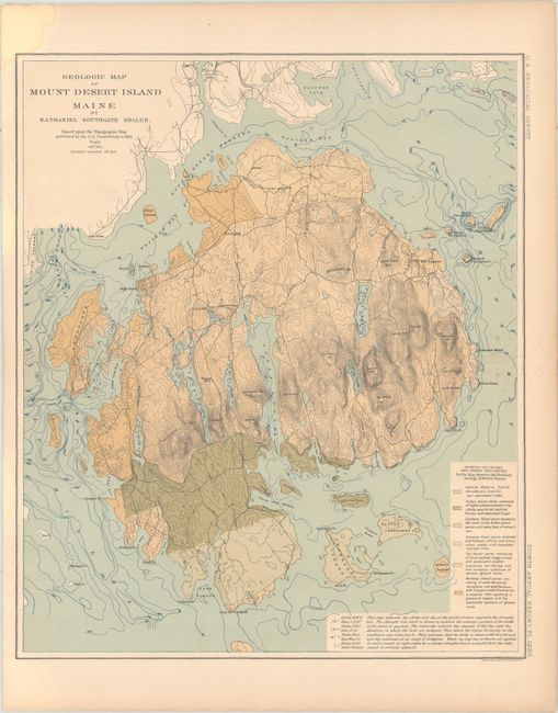
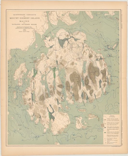
"[Lot of 2] Geologic Map of Mount Desert Island Maine [and] Quaternary Deposits of Mount Desert Island Maine", U.S. Geological Survey (USGS)

Subject: Eastern Maine

Period: 1889 (circa)

Publication: U.S. Geological Survey Eighth Annual Report

Color: Printed Color

Size:
10.4 x 12.4 inches
26.4 x 31.5 cm
Download High Resolution Image
(or just click on image to launch the Zoom viewer)

These two geological maps were issued about 30 years prior to the formation of Acadia National Park. The maps were included in Nathaniel Shaler's geological report of the island that was published in the 8th Annual Report of the U.S. Geological Survey. The first map depicts the geology of the underlying bedrock, while the second map presents the areas of the island where bedrock lies near the surface. In addition to the geology, the maps shows detailed topography via contour lines, depth soundings, villages and towns.

References:

Condition: B+

Light toning with a few faint spots in the images. There is a small damp stain in the top left corner of the first map.

Estimate: $120 - $150

Sold for: $190

Closed on 11/15/2017

Archived