Catalog Archive
Auction 165, Lot 216

Early Edition with Mining Vignette

"Page's Map of Colorado", Page, H. R.
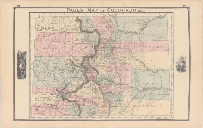
Subject: Colorado

Period: 1881 (dated)

Publication:

Color: Hand Color

Size:
24.7 x 16.1 inches
62.7 x 40.9 cm
Download High Resolution Image
(or just click on image to launch the Zoom viewer)

This rare, early edition map of the state shows early county development including the immense counties of Arapahoe, Elbert, Bent, Weld and Las Animas in the eastern plains. Several railroads are shown including a branch of the Denver & Rio Grande that extends to Florida in La Plata County. Page made regular updates to this map as the 1886 edition would show an extension of this railroad to include Silverton and Howardsville (a line that was proposed but never actually built). The map locates many towns and mines and provides an excellent view of the topography. Telluride is located but no roads are shown in the area. Some uncommon place names appear including Tennessee Colony near Ft. Morgan and Greeley. This early edition includes a mining vignette and also has a blank verso.

References:

Condition: A

Attractive original hand color on a clean sheet.

Estimate: $600 - $750

Sold for: $375

Closed on 11/15/2017

Archived