Catalog Archive
Auction 165, Lot 213

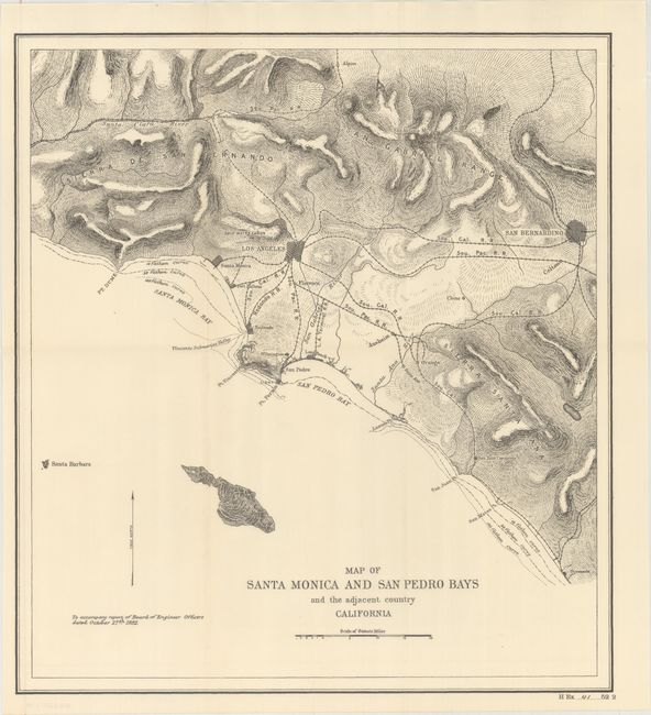
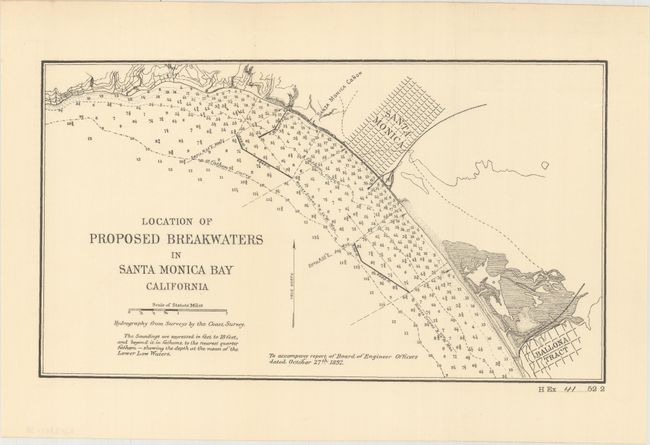
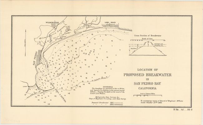
"[Lot of 3] Map of Santa Monica and San Pedro Bays and the Adjacent Country California [and] Location of Proposed Breakwaters in Santa Monica Bay California [and] Location of Proposed Breakwater in San Pedro Bay California", U.S. Corps of Engineers

Subject: Los Angeles, California

Period: 1892 (dated)

Publication: HR Ex. Doc. 41, 52nd Cong., 2nd Sess.

Color: Black & White

Size:
See Description
Download High Resolution Image
(or just click on image to launch the Zoom viewer)

A nice set of maps showing proposed internal improvements in the Santa Monica and San Pedro bays including:

A. Map of Santa Monica and San Pedro Bays and the Adjacent Country California (13.9 x 15.3"). Covers the coastline from Santa Monica south to Oceanside and east to San Berdardino. Cities are shown in street-grid pattern with lines of the Southern Pacific Railroad linking them together. Relief is well-developed and fathom lines are drawn in the waters along the coast.

B. Location of Proposed Breakwaters in Santa Monica Bay California (11.7 x 6.6") and C. Location of Proposed Breakwater in San Pedro Bay California (13.1 x 6.8"). Depicts the proposed breakwaters in the two bays with numerous soundings filling the waters.

References:

Condition: A+

Fine impressions on clean sheets.

Estimate: $200 - $230

Sold for: $300

Closed on 11/15/2017

Archived