Catalog Archive
Auction 165, Lot 205

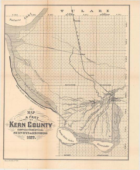
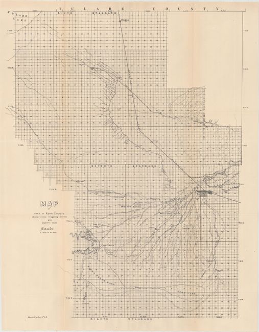
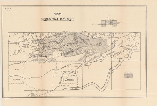
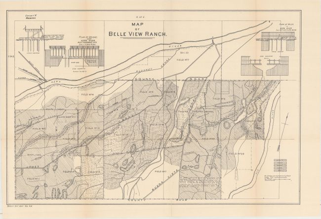
"[Lot of 4] Map of a Part of Kern County... [and] Map of Part of Kern County Showing Various Irrigating Ditches and Adjacent Lands [and] Map of McClung Ranch [and] Map of Belle View Ranch", U.S. Government

Subject: Central California

Period: 1877 (circa)

Publication: House Ex. Doc. No. 46

Color: Black & White

Size:
See Description
Download High Resolution Image
(or just click on image to launch the Zoom viewer)

These four scarce maps were issued in a government report related to a water rights dispute in Kern County. Competing interests between canal owners diverting water from Tulare Lake and the Kern River led to numerous lawsuits with the end result being the creation of the "California Doctrine." The doctrine governed water usage through a combination of riparian rights (abutting to a river) and appropriative rights (diverting river water). The California Doctrine became the model across the west as agricultural and population growth required an equitable approach to allocating a limited resource over a wide geographic footprint. The list of maps include:

A. Map of a Part of Kern County Compiled from Official Surveys & Records, dated 1877 (13.9 x 17.0"). Shows the natural drainage from Tulare Lake along with the numerous canals diverting the natural water flow.

B. Map of Part of Kern County Showing Various Irrigating Ditches and Adjacent Lands (19.4 x 24.8"). A larger scale map of the above that includes several ranches impacted by the water diversion.

C. Map of McClung Ranch (17.8 x 11.4") and D. Map of Belle View Ranch (17.7 x 11.8"). Shows a close up of several canal systems and the crops being grown.

References:

Condition: B+

Issued folding with light toning. The "Map of a Part of Kern County" also has a 3" fold separation at left that has been closed on verso with archival tape.

Estimate: $200 - $250

Sold for: $650

Closed on 11/15/2017

Archived