Catalog Archive
Auction 165, Lot 179

"Oregon and Upper California", Mitchell, Samuel Augustus

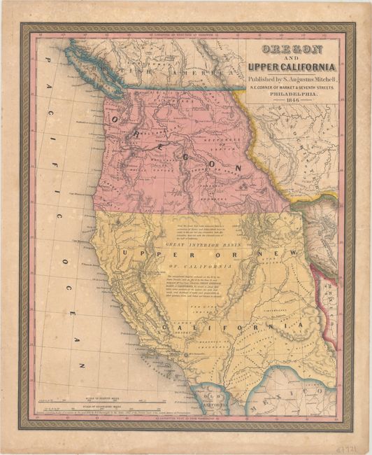
Subject: Western United States

Period: 1846 (dated)

Publication: A New Universal Atlas

Color: Hand Color

Size:
12.6 x 15.4 inches
32 x 39.1 cm
Download High Resolution Image
(or just click on image to launch the Zoom viewer)

This great map is the first edition in this series of 14 significant maps depicting the rapidly changing American West. Oregon Territory is shown west of the Continental Divide with the northern Boundary of 1846 and the southern Boundary of 1819. Oregon City is shown as the capital. Lewis and Clarke's route, Fremont's Route, and the Oregon Trail are noted through wilderness dotted with a few missions, forts, and numerous Indian tribes. The area labeled Upper or New California includes present-day California, Nevada, Utah, Arizona, and parts of New Mexico, Colorado, and Wyoming. The capital is at Monterey, and the region where gold will eventually be found is named Nueva Helvetia. The unexplored interior is labeled and described as the Great Interior Basin of California, which is transversed by the Great Spanish Trail from P. Angelos to Santa Fe. The border with Mexico is substantially south of its true location leaving an expansive U.S. coastline on the Gulf of California.

References:

Condition: B

Original color with light scattered foxing and toning. A short edge tear just enters the border at right, and the top right edge is reinforced on verso by linen tape.

Estimate: $500 - $650

Sold for: $350

Closed on 11/15/2017

Archived