Catalog Archive
Auction 165, Lot 174

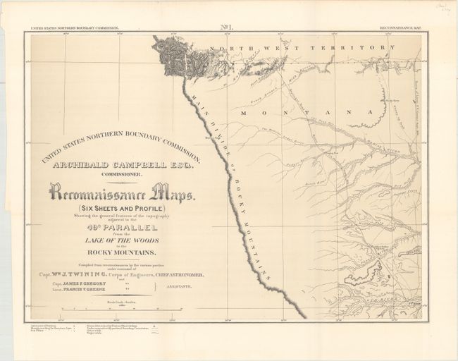
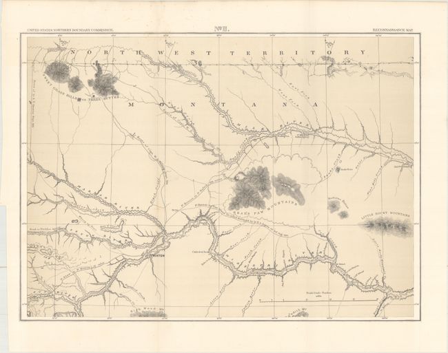
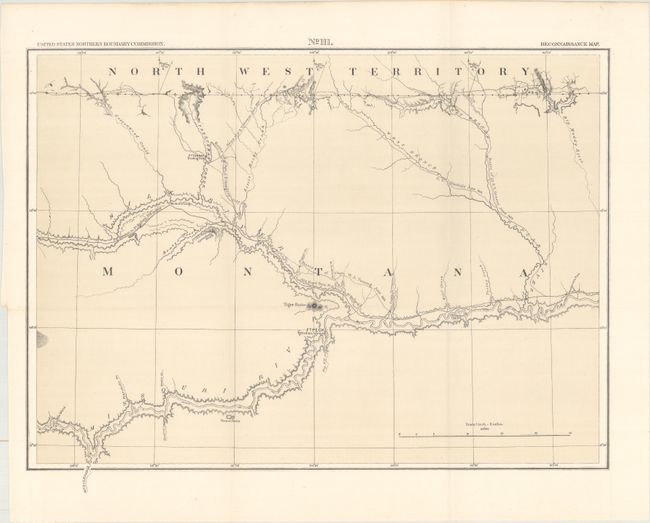
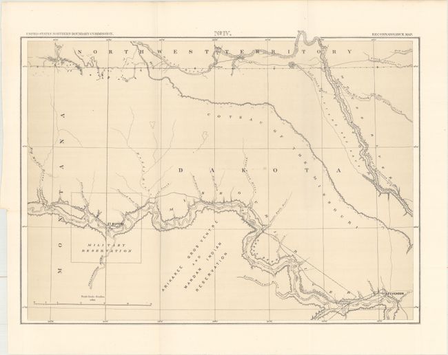
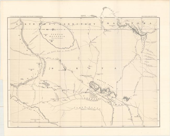
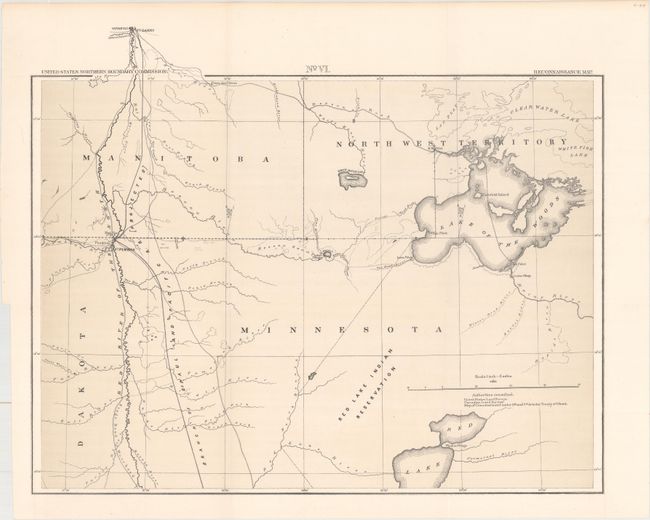
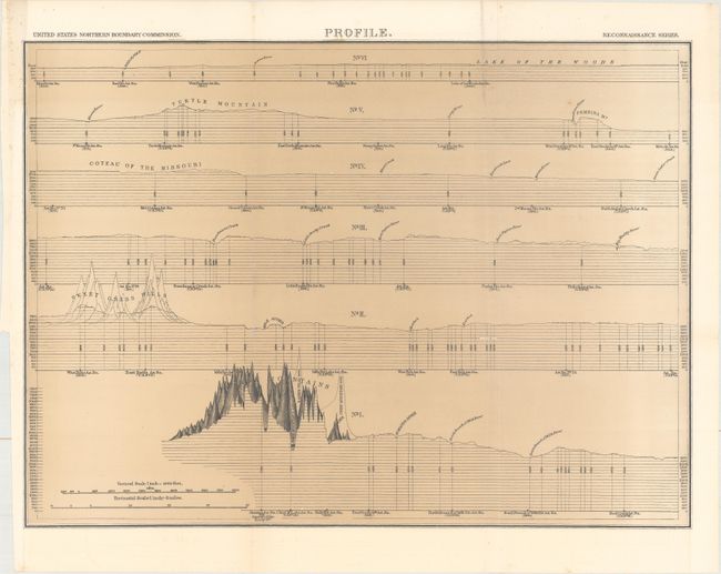
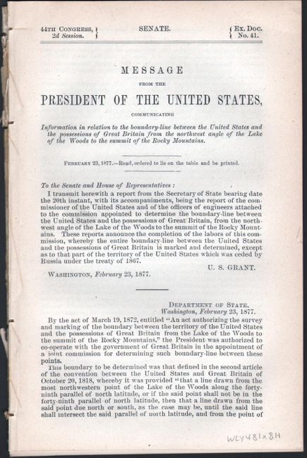
"[Lot of 8] Reconnaissance Maps. (Six Sheets and Profile) Showing the General Features of the Topography Adjacent to the 49th Parallel from the Lake of the Woods to the Rocky Mountains [with report]", Twining, William J. (Capt.)

Subject: Upper Midwestern United States

Period: 1877 (published)

Publication: Sen. Ex. Doc. 41, 44th Cong., 2nd Sess.

Color: Black & White

Size:
21.3 x 15.4 inches
54.1 x 39.1 cm
Download High Resolution Image
(or just click on image to launch the Zoom viewer)

A complete and matching set of six maps, profile sheet, and 49 page report on the Northern Boundary Survey. In 1872, Congress authorized a survey to determine and mark the U.S. - Canadian Boundary line along the 49th parallel. The survey accurately determined the boundary, and added very detailed topographical features in a 5-mile wide strip along the line. The survey was completed in 1875 and published by Archibald Campbell and William Twining in 1878. These maps cover the area from the Rocky Mountains in Montana to the Lake of the Woods in Minnesota and 100 miles north to south. They provide excellent detail of rivers, towns and forts, springs, and topographical data. Locates the Blackfoot Indian Agency, Ft. Shaw, Ft. Benton, River Crow Indian Agency, Ft. Belknap, Old Fr. Browning, Ft. Turnay, Ft. Peck, Ft. Hawley, Ft. Buford, Ft. Berthold, Ft. Stevenson, Ft. Totten, Ft. Pembina, and Ft. Garry (Canada), plus numerous trading posts, Indian villages, and much more. A historically important set of maps.

References: Wheat (TMW) #1289.

Condition: A

The maps are clean and bright with a few minor spots of foxing on two sheets, and mostly confined to the blank margins. The profile has a few tiny splits at fold intersections. Disbound text is near fine.

Estimate: $300 - $375

Sold for: $220

Closed on 11/15/2017

Archived