Catalog Archive
Auction 165, Lot 143

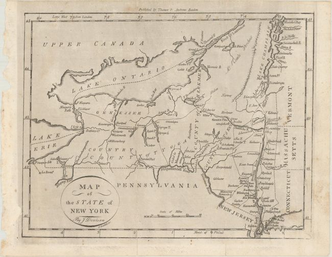
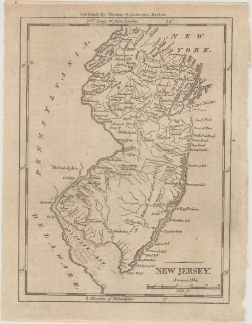
"[Lot of 2] Map of the State of New York [and] New Jersey", Morse, Jedidiah (Rev.)

Subject: New York, New Jersey

Period: 1796 (circa)

Publication: The American Universal Geography

Color: Black & White

Size:
See Description
Download High Resolution Image
(or just click on image to launch the Zoom viewer)

These early state maps from Morse's The American Universal Geography show topography, watershed, town names, and more. Meridians are from both London and Philadelphia. Published by Thomas & Andrews, Boston.

A. Map of the State of New York (9.5 x 7.4"). In the lower portion of the state there is an area marked Ceded to Massachusetts. Chautauqua Lake appears as Calaughaque L. Drawn by J. Denison, engraved by Amos Doolittle. Condition: There are a few faint spots of foxing and a 2.5" centerfold separation at bottom that has been archivally repaired on verso.

B. New Jersey (5.6 x 7.4"). The distance scale is in "American Miles." The area extends from the tip of Long Island and Manhattan to the shoals in Delaware Bay. Engraved by Samuel Hill. Condition: Light offsetting and a few small spots of foxing.

References: McCorkle (18th C. Geography Books) #304-7 & 8; Wheat & Brun #368 & #417.

Condition: B+

Issued folding. See description above.

Estimate: $130 - $160

Sold for: $95

Closed on 11/15/2017

Archived