Catalog Archive
Auction 165, Lot 141

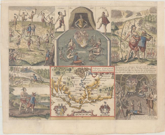
"A Description of Part of the Adventures of Cap Smith in Virginia", Smith, John (Capt.)

Subject: Mid-Atlantic United States

Period: 1819 (published)

Publication: The True Travels, Adventures and Observations of Captaine John Smith...

Color: Hand Color

Size:
14.1 x 10.9 inches
35.8 x 27.7 cm
Download High Resolution Image
(or just click on image to launch the Zoom viewer)

This is a fine quality nineteenth century reproduction of one of John Smith's important maps of America. This small map (6 x 4.75") covers the region first settled by Walter Raleigh at Roanoak Island, in present-day North Carolina. It is based on the White/De Bry map of 1590, with a few additional place names. The map is surrounded by engravings of his adventures, including his capture by King of Pamaunkee and his rescue by Pocahontas. Finely engraved on high quality paper and published in the first American edition of Smith's history published in Richmond, Virginia.

References:

Condition: A

Issued folding, now flattened with minor soiling. A binding trim at top right has been replaced with old paper, and an adjacent 1.5" binding tear has been archivally repaired.

Estimate: $400 - $475

Sold for: $450

Closed on 11/15/2017

Archived