Catalog Archive
Auction 165, Lot 137

"A Map of That Part of America Where a Degree of Latitude Was Measured for the Royal Society by Cha: Mason & Jere: Dixon", Mynde, James

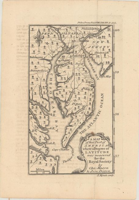
Subject: Colonial Mid-Atlantic United States

Period: 1769 (circa)

Publication: The Philosophical Transactions

Color: Black & White

Size:
4.1 x 6.6 inches
10.4 x 16.8 cm
Download High Resolution Image
(or just click on image to launch the Zoom viewer)

This is the rare first edition of this interesting little map that covers the Delaware peninsula north to Philadelphia, with only a few cities and roads including Annapolis, Baltimore, and Greenwich. It locates many early settlements and shows the roads that connect them. The focus of the map is the initial measurements made by Charles Mason and Jeremiah Dixon for what has become known as the Mason-Dixon Line. These two British astronomers were employed to make this survey in order to resolve a long-standing dispute between the Calvert family, proprietors of Maryland, and the Penn family of Pennsylvania. This map, one of the first to show the results of the Mason Dixon survey, shows this initial degree of latitude set into the context of the lands around the Chesapeake and Delaware Bays. This edition appeared in The Philosophical Transactions of the Royal Society of London, reflecting the general public interest in this border dispute in the American colonies. A later edition of this map was published the following year in the December 1769 issue of Gentleman's Magazine.

References: cf. Jolly #GENT-199.

Condition: B+

A fine impression with light offsetting from an opposing page of text and a small spot around the title cartouche.

Estimate: $350 - $450

Sold for: $750

Closed on 11/15/2017

Archived